Category:Maps of United States census statistical areas
Jump to navigation
Jump to search
Subcategories
This category has the following 49 subcategories, out of 49 total.
A
C
I
K
M
N
O
P
S
T
V
Media in category "Maps of United States census statistical areas"
The following 15 files are in this category, out of 15 total.
-
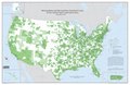 CBSA WallMap Sep2018.pdf 8,325 × 5,400; 6.23 MB
-
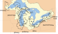 CensusStatisticalAreasoftheGreatLakes.svg 650 × 375; 210 KB
-
 Combined Statistical Areas (CSAs) of the United States and Puerto Rico, Mar 2020.gif 4,096 × 2,658; 2.13 MB
-
 Combined Statistical Areas (CSAs) of the United States and Puerto Rico, Mar 2020.png 11,100 × 7,200; 13.08 MB
-
 Combined statistical areas of the United States and Puerto Rico 2013.gif 3,850 × 2,446; 1,015 KB
-
 Combined statistical areas of the United States and Puerto Rico.gif 4,000 × 2,571; 1.04 MB
-
 Core Based Statistical Areas.png 2,112 × 1,632; 113 KB
-

-

-

-

-

-
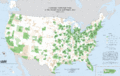
 Metropolitan and Micropolitan Statistical Areas of the United States and Puerto Rico.gif 4,000 × 2,571; 1.06 MB
-
 Metropolitan and Micropolitan Statistical Areas of the United States and Puerto Rico.svg 3,850 × 2,446; 13.43 MB
-
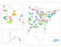 US Combined Statistical Areas.png 2,112 × 1,632; 77 KB

_of_the_United_States_and_Puerto_Rico,_Mar_2020.gif)
_of_the_United_States_and_Puerto_Rico,_Mar_2020.png)


_of_the_United_States_and_Puerto_Rico,_Aug_2017.gif)
_of_the_United_States_and_Puerto_Rico,_Aug_2017.PNG)
_of_the_United_States_and_Puerto_Rico,_Feb_2013.gif)
_of_the_United_States_and_Puerto_Rico,_Mar_2020.gif)
_of_the_United_States_and_Puerto_Rico,_Mar_2020.png)


