Category:Maps of borders of the Central African Republic
Jump to navigation
Jump to search
Countries of Africa: Algeria · Angola · Botswana · Burkina Faso · Burundi · Cameroon · Central African Republic · Chad · Democratic Republic of the Congo · Republic of the Congo · Djibouti · Egypt‡ · Eswatini · Ethiopia · Gabon · Ghana · Guinea · Guinea-Bissau · Ivory Coast · Kenya · Lesotho · Liberia · Libya · Malawi · Mali · Mauritania · Morocco · Mozambique · Namibia · Niger · Nigeria · Rwanda · Senegal · Sierra Leone · Somalia · South Africa · South Sudan · Sudan · Tanzania · Togo · Tunisia · Uganda · Zambia · Zimbabwe
Limited recognition: Ambazonia · Somaliland – Other areas: Western Sahara
‡: partly located in Africa
Limited recognition: Ambazonia · Somaliland – Other areas: Western Sahara
‡: partly located in Africa
Media in category "Maps of borders of the Central African Republic"
The following 8 files are in this category, out of 8 total.
-
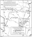 CAR-PR Congo border map.png 835 × 951; 264 KB
-
 Central African Republic-Chad Boundary.jpg 2,871 × 1,735; 1.46 MB
-
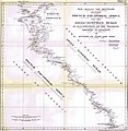
 Central African Republic-Congo (Kinshasa) boundary. LOC 85697535.jpg 4,151 × 3,184; 1.28 MB
-
 Central African Republic-Congo (Kinshasa) boundary. LOC 85697535.tif 4,151 × 3,184; 37.81 MB
-
 Central African Republic-Democratic Republic of the Congo Boundary.jpg 2,841 × 2,034; 1.95 MB
-
 Central African Republic-Sudan Boundary.jpg 400 × 481; 40 KB
-
 Map of the Central African Republic-Cameroon border.png 716 × 1,002; 290 KB
-


_boundary._LOC_85697535.jpg)


