Category:Maps of borders of Tanzania
Jump to navigation
Jump to search
Countries of Africa: Algeria · Angola · Botswana · Burkina Faso · Burundi · Cameroon · Central African Republic · Chad · Democratic Republic of the Congo · Republic of the Congo · Djibouti · Egypt‡ · Eswatini · Ethiopia · Gabon · Ghana · Guinea · Guinea-Bissau · Ivory Coast · Kenya · Lesotho · Liberia · Libya · Malawi · Mali · Mauritania · Morocco · Mozambique · Namibia · Niger · Nigeria · Rwanda · Senegal · Sierra Leone · Somalia · South Africa · South Sudan · Sudan · Tanzania · Togo · Tunisia · Uganda · Zambia · Zimbabwe
Limited recognition: Ambazonia · Somaliland – Other areas: Western Sahara
‡: partly located in Africa
Limited recognition: Ambazonia · Somaliland – Other areas: Western Sahara
‡: partly located in Africa
Media in category "Maps of borders of Tanzania"
The following 10 files are in this category, out of 10 total.
-
 1st parallel Tanzania.png 329 × 353; 35 KB
-
 Burundi-Tanzania border.jpg 828 × 1,070; 116 KB
-
 DRC-Tanzania border.png 811 × 1,111; 282 KB
-
 Kenya-Tanzania border 1.jpg 976 × 757; 201 KB
-
 Kenya-Tanzania border 2.jpg 2,647 × 2,126; 638 KB
-
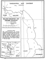 Malawi-Tanzania border.png 856 × 1,113; 322 KB
-
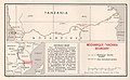 Mozambique-Tanzania border.jpg 1,008 × 621; 184 KB
-
 Rwanda-Tanzania border.png 866 × 1,273; 414 KB
-
 Tanzania-Uganda border.png 1,148 × 836; 572 KB
-
 Tanzania-Zambia border.png 1,198 × 776; 289 KB


