Category:Maps of borders of Venezuela
Jump to navigation
Jump to search
| NO WIKIDATA ID FOUND! Search for Maps of borders of Venezuela on Wikidata | |
| Upload media |
Subcategories
This category has the following 5 subcategories, out of 5 total.
Media in category "Maps of borders of Venezuela"
The following 17 files are in this category, out of 17 total.
-
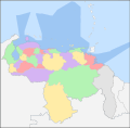
Administracion politica territorial.png 614 × 599; 76 KB
-
Caribbean maritime boundaries map zh.svg 3,561 × 2,221; 2.87 MB
-
Caribbean maritime boundaries map.svg 3,561 × 2,221; 2.78 MB
-
Caribbean maritime boundaries map mk.svg 3,561 × 2,221; 5.52 MB
-
Mapa das Caraíbas (fronteiras marítimas).svg 3,561 × 2,221; 2.86 MB
-
Mapa del Caribe (límites marinos).svg 5,340 × 3,660; 3.02 MB
-
Mapa del Mar Caribe (límites marinos)-fr.svg 3,587 × 2,221; 1.91 MB
-
Mapa del Mar Caribe (límites marinos).svg 3,587 × 2,221; 1.98 MB
-
Disputed Areas Venezuela-Guyana-Suriname-FrenchGuiana.svg 842 × 595; 227 KB
-
Frontières entre la France et le Vénézuela.svg 1,940 × 1,424; 1.16 MB
-
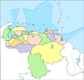
Localizador Politico de Venezuela.svg 534 × 614; 145 KB
-
Localizador Politico Venezuela.svg 623 × 612; 148 KB
-
Límites marítimos de Venezuela.png 732 × 558; 22 KB
-
Mappa das republicas de Venezuela, Nova Granada e Ecuador - btv1b8441178s.jpg 4,776 × 3,577; 3.06 MB
-
VE-Dependencias Federales ubicacion.png 3,934 × 2,048; 1.36 MB
-
Venezuela Political Locator.svg 623 × 598; 170 KB
-
Venezuelamapaconfrenteatlantico.jpg 2,550 × 2,516; 176 KB


