Category:Maps of borders of Argentina
Jump to navigation
Jump to search
Subcategories
This category has only the following subcategory.
A
Media in category "Maps of borders of Argentina"
The following 18 files are in this category, out of 18 total.
-
 35th parallel Argentina.png 520 × 1,004; 39 KB
-
 42th parallel Argentina.PNG 520 × 1,004; 36 KB
-
 Alas delta s.jpg 992 × 768; 330 KB
-
 Argentina-Bolivia border.png 1,352 × 1,032; 149 KB
-
 Argentina-Brazil border.png 999 × 1,343; 183 KB
-
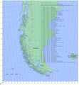
 Argentina-Chile border (part).jpg 885 × 1,192; 110 KB
-
 Argentina-Paraguay border.png 1,000 × 1,344; 191 KB
-
 Argentina-Uruguay border.jpg 727 × 987; 196 KB
-
 Argentine map of Argentina.png 990 × 1,853; 247 KB
-
 Baselines chile.png 1,653 × 1,787; 894 KB
-
 ETH-BIB-Karte Argentinische-, Chilenische-Boundary-Dia 247-02577.tif 2,897 × 3,468; 9.67 MB
-
 Isla Timoteo Dominguez-Martin Garcia.png 1,058 × 1,374; 152 KB
-

-
 Mapa Argentino según presentación CLPC-ONU - 2009.png 419 × 589; 440 KB
-
 Mar de Resguardo Patrimonial Argentino.png 1,148 × 1,512; 289 KB
-
 Meridiano V Map.PNG 520 × 1,004; 36 KB
-
 PascuaLamaPlanMap.png 448 × 463; 228 KB
-


.jpg)


.png)


