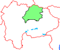
Category:Maps of Yamanashi prefecture
Jump to navigation
Jump to search
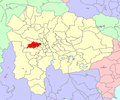
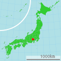
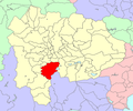
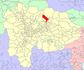
日本語: 山梨県の地図のカテゴリ。 日本全体における県の位置図は"Locator maps of ~"を、県内における各市町村の位置図は"Locator maps of municipalities ~"を、各郡の地図は"Maps of districts ~"を、過去の市町村の地図は"Maps of former municipalities ~"を参照。
한국어: 야마나시현의 지도에 관한 분류입니다. 일본 전체의 위치도는 "Locator maps of ~"를, 현 내의 각 시정촌의 위치도는 "Locator maps of municipalities ~"를, 각 군의 지도는 "Maps of districts ~"를, 과거의 시정촌의 지도는 "Maps of former municipalities ~"를 참조하세요.
Wikimedia category | |||||
| Upload media | |||||
| Instance of | |||||
|---|---|---|---|---|---|
| Category combines topics | |||||
| Yamanashi Prefecture | |||||
prefecture of Japan | |||||
| Instance of | |||||
| Named after |
| ||||
| Location | Japan | ||||
| Visitor center |
| ||||
| Capital | |||||
| Legislative body | |||||
| Executive body | |||||
| Anthem |
| ||||
| Head of government |
| ||||
| Has part(s) |
| ||||
| Legal form |
| ||||
| Highest point |
| ||||
| Population |
| ||||
| Area |
| ||||
| Replaces |
| ||||
| official website | |||||
 | |||||
Subcategories
This category has the following 6 subcategories, out of 6 total.
P
Pages in category "Maps of Yamanashi prefecture"
This category contains only the following page.
Media in category "Maps of Yamanashi prefecture"
The following 61 files are in this category, out of 61 total.
-
Flag map of Yamanashi Prefecture.svg 431 × 447; 1 KB
-
AshiwadaVil-YamanashiPref.png 600 × 500; 97 KB
-
AshiyasuVil-YamanashiPref.png 600 × 500; 97 KB
-
FormerNambuTown-YamanashiPref.png 600 × 500; 97 KB
-
FormerYamanashiCity-YamanashiPref.png 600 × 500; 97 KB
-
GappeiChizu YamanashiKen.png 174 × 148; 5 KB
-
Japan chubu Hokuriku region map small.png 1,397 × 1,593; 104 KB
-
Japan chubu koshinetsu region map small.png 1,397 × 1,593; 104 KB
-
Japan chubu map small.png 235 × 300; 6 KB
-
Japan Koshin Region.png 1,397 × 1,593; 89 KB
-
Japan prov map kai.png 235 × 300; 6 KB
-
Japan Yamanashi Prefecture location map.svg 503 × 521; 11 KB
-
Japan- Yamanashi-Ken - DPLA - 4c7477b6f78e5bbcc5a3f7bad34c767a.jpg 8,172 × 6,307; 4.5 MB
-
Japón, Fuji (2005) 01.jpg 1,044 × 726; 796 KB
-
KatsuyamaVil-YamanashiPref.png 600 × 500; 97 KB
-
KawaguchikoTown-YamanashiPref.png 600 × 500; 97 KB
-
Kobuchisawa Town Outline Map.png 640 × 800; 50 KB
-
KosaiTown-YamanashiPref.png 600 × 500; 97 KB
-
KushigataTown-YamanashiPref.png 600 × 500; 97 KB
-
Map of Japan with highlight on 19 Yamanashi prefecture.svg 1,024 × 1,024; 15 KB
-
Map of license plates in Yamanashi Japan.svg 503 × 521; 34 KB
-
Map of Yamanashi Prefecture Ja.svg 503 × 521; 10 KB
-
NakatomiTown-YamanashiPref.png 600 × 500; 97 KB
-
Route Map of Minobu Line.svg 522 × 587; 8 KB
-
Shadow picture of Yamanashi prefecture.png 377 × 393; 2 KB
-
ShimobeTown-YamanashiPref.png 600 × 500; 97 KB
-
ShiraneTown-YamanashiPref.png 600 × 500; 97 KB
-
Shizuoka et Yamanashi geolocalisation.svg 1,052 × 859; 2.54 MB
-
SuwaTown-YamanashiPref.png 640 × 540; 142 KB
-
TomizawaTown-YamanashiPref.png 600 × 500; 97 KB
-
Yamanashi -map.jpg 2,000 × 2,060; 580 KB
-
Yamanashi géolocalisation relief.svg 744 × 779; 2.02 MB
-
Yamanashi géolocalisation.svg 744 × 779; 1.56 MB
-
Yamanashi Hayakawa-town.png 174 × 148; 3 KB
-
Yamanashi HigashiYamanashi-gun.png 174 × 147; 3 KB
-
Yamanashi HigashiYatsushiro-gun.png 174 × 147; 3 KB
-
Yamanashi KitaKoma-gun.png 174 × 147; 3 KB
-
Yamanashi Koma-gun.png 174 × 147; 3 KB
-
Yamanashi Kosuge-vill.png 174 × 148; 3 KB
-
Yamanashi Minobu-town 1955-2004.png 174 × 148; 3 KB
-
Yamanashi Minobu-town.png 174 × 148; 3 KB
-
Yamanashi Narusawa-vill.png 174 × 148; 3 KB
-
Yamanashi NishiYamanashi-gun.png 174 × 147; 3 KB
-
Yamanashi Showa-town.png 174 × 148; 3 KB
-
Yamanashi Tabayama-vill.png 174 × 148; 3 KB
-
Yamanashi Tamaho-town.png 174 × 148; 3 KB
-
Yamanashi Tatomi-town.png 174 × 148; 3 KB
-
Yamanashi Tsuru-gun.png 174 × 147; 3 KB
-
Yamanashi Yamanashi-gun.png 174 × 147; 3 KB
-
Yamanashi Yatsushiro-gun.png 174 × 147; 3 KB
-
Yamanashi-geo-stub.png 647 × 671; 33 KB
-
Yamanashi-pref Small ver2.png 275 × 266; 15 KB
-
Yamanashi-pref.png 174 × 148; 5 KB
-
YamanashiMapCurrent.png 1,001 × 801; 36 KB
-
地図 ナンバープレート 19000.svg 503 × 521; 10 KB
-
地図-山梨県-1878.png 174 × 147; 3 KB
-
地図-山梨県八代郡.png 174 × 147; 3 KB
-
地図-山梨県山梨郡.png 174 × 147; 2 KB
-
地図-山梨県巨摩郡.png 174 × 147; 2 KB
-
基礎自治体位置図 19430.svg 503 × 521; 10 KB


