Category:Maps of Fukushima prefecture
Appearance
日本語: 福島県の地図のカテゴリ。 日本全体における県の位置図は"Locator maps of ~"を、県内における各市町村の位置図は"Locator maps of municipalities ~"を、各郡の地図は"Maps of districts ~"を、過去の市町村の地図は"Maps of former municipalities ~"を参照。
Wikimedia category | |||||
| Upload media | |||||
| Instance of | |||||
|---|---|---|---|---|---|
| Category combines topics | |||||
| Fukushima Prefecture | |||||
prefecture of Japan | |||||
| Instance of | |||||
| Part of |
| ||||
| Named after |
| ||||
| Location | Japan | ||||
| Capital | |||||
| Legislative body |
| ||||
| Executive body | |||||
| Anthem |
| ||||
| Head of government |
| ||||
| Mascot |
| ||||
| Has part(s) |
| ||||
| Legal form |
| ||||
| Inception |
| ||||
| Significant event | |||||
| Highest point |
| ||||
| Population |
| ||||
| Area |
| ||||
| Replaces |
| ||||
| official website | |||||
 | |||||
Subcategories
This category has the following 11 subcategories, out of 11 total.
Pages in category "Maps of Fukushima prefecture"
This category contains only the following page.
Media in category "Maps of Fukushima prefecture"
The following 87 files are in this category, out of 87 total.
-
Flag map of Fukushima Prefecture.svg 831 × 659; 7 KB
-
Abukuma River period 1-5.jpg 1,500 × 800; 1.36 MB
-
Abukuma River period 1.jpg 1,500 × 800; 1.33 MB
-
Abukuma River period 2.jpg 1,500 × 800; 1.33 MB
-
Abukuma River period 3.jpg 1,500 × 800; 1.33 MB
-
Abukuma River period 4.jpg 1,500 × 800; 1.33 MB
-
Abukuma River period 5.jpg 1,500 × 800; 1.33 MB
-
Admiralty Chart No 1495 Yuya Wan to Ando Zaki, Published 1897, Large Corrections 1906.jpg 16,177 × 11,114; 51.51 MB
-
Admiralty Chart No 1495 Yuya Wan to Ando Zaki, Published 1897, Large Corrections 1936.jpg 16,277 × 11,142; 46.91 MB
-
Bandai-1888-hisai1.jpg 612 × 822; 119 KB
-
Bandai-1888-hisai2.jpg 518 × 639; 58 KB
-
Fukushima -map.png 1,800 × 1,445; 1.33 MB
-
Fukushima -map1.png 5,000 × 3,882; 6.07 MB
-
Fukushima Adachi-gun.png 340 × 220; 7 KB
-
Fukushima Aizu Map.jpg 641 × 451; 19 KB
-
Fukushima Aizu-gun.png 340 × 220; 7 KB
-
Fukushima Aizubange-town.png 337 × 241; 7 KB
-
Fukushima Aizumisato-town.png 337 × 241; 7 KB
-
Fukushima Aizuwakamatsu-city.png 337 × 241; 7 KB
-
Fukushima Asaka-gun.png 340 × 220; 7 KB
-
Fukushima Asakawa-town.png 337 × 241; 7 KB
-
Fukushima Bandai-town.png 337 × 241; 7 KB
-
Fukushima Date-city.png 337 × 241; 7 KB
-
Fukushima Date-gun.png 340 × 220; 7 KB
-
Fukushima Date-town.png 337 × 241; 5 KB
-
Fukushima Futaba-gun.png 340 × 220; 7 KB
-
Fukushima Hamadōri Map.jpg 641 × 451; 21 KB
-
Fukushima HigashiShirakawa-gun.png 340 × 220; 7 KB
-
Fukushima Ishikawa-gun.png 340 × 220; 12 KB
-
Fukushima Iwaki-gun1.png 340 × 220; 9 KB
-
Fukushima Iwaki-gun2.png 340 × 220; 9 KB
-
Fukushima Iwasaki-gun.png 340 × 220; 9 KB
-
Fukushima Iwase-gun.png 340 × 220; 7 KB
-
Fukushima Kawanuma-gun.png 340 × 220; 7 KB
-
Fukushima Kikuta-gun.png 340 × 220; 9 KB
-
Fukushima KitaAizu-gun.png 340 × 220; 7 KB
-
Fukushima MinamiAizu-gun.png 340 × 220; 7 KB
-
Fukushima Nakadōri Map.jpg 641 × 451; 19 KB
-
Fukushima Namekata-gun.png 340 × 220; 9 KB
-
Fukushima Naraha-gun.png 340 × 220; 9 KB
-
Fukushima NishiShirakawa-gun.png 340 × 220; 7 KB
-
Fukushima Onuma-gun.png 340 × 220; 7 KB
-
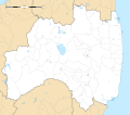
Fukushima Prefecture regional boundaries map.svg 800 × 712; 25 KB
-
Fukushima Shineha-gun.png 340 × 220; 9 KB
-
Fukushima Shinobu-gun.png 340 × 220; 7 KB
-
Fukushima Souma-gun.png 340 × 220; 11 KB
-
Fukushima Tamura-gun.png 340 × 220; 7 KB
-
Fukushima Uda-gun.png 340 × 220; 8 KB
-
Fukushima Yama-gun.png 340 × 220; 7 KB
-
Fukushima-geo-stub.png 1,134 × 899; 61 KB
-
Fukushima-ken géolocalisation relief.svg 1,719 × 1,509; 3.08 MB
-
Fukushima-ken géolocalisation.svg 1,719 × 1,509; 2.99 MB
-
Fukushima-pref.png 337 × 241; 5 KB
-
FukushimaMapCurrent.png 1,281 × 901; 50 KB
-
Growth rate map of municipalities of Fukushima prefecture, Japan.svg 800 × 712; 34 KB
-
Iwase-village.png 300 × 215; 63 KB
-
Japan Fukushima Map Chikei.png 360 × 280; 55 KB
-
Japan prov map iwaki718.png 250 × 319; 7 KB
-
Japan prov map iwase718.png 250 × 319; 7 KB
-
Japan prov map mutsu.png 235 × 300; 6 KB
-
Japan prov map mutsu701.png 250 × 320; 7 KB
-
Japan prov map mutsu718.png 250 × 319; 7 KB
-
Japan- Fukushima-Ken - DPLA - 8749efb582f2d054382f9344a9aa1d4f.jpg 8,136 × 6,329; 4.46 MB
-
Map of Fukushima Prefecture Ja.svg 564 × 454; 23 KB
-
Map of Japan with highlight on 07 Fukushima prefecture.svg 1,024 × 1,024; 15 KB
-
Map of license plates in Fukushima Japan.svg 640 × 512; 139 KB
-
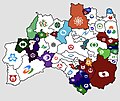
Municipal flag map of Fukushima Prefecture.jpg 1,139 × 960; 569 KB
-
Naganuma-town.png 300 × 215; 63 KB
-
Nishinezeki.jpg 1,233 × 819; 113 KB
-
OSM Hachijurigoe.png 460 × 460; 51 KB
-
RengaDori SchematicView1.png 1,300 × 480; 68 KB
-
Shadow picture of Fukushima prefecture.png 504 × 401; 3 KB
-
Soma Domain.jpg 683 × 600; 92 KB
-
Supply area of Niigata Electric 2.svg 1,500 × 1,150; 61 KB
-
Supply area of Niigata Electric Power 2.svg 1,500 × 1,150; 167 KB
-
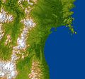
The topography surrounding Sendai.jpg 6,330 × 5,879; 4.69 MB
-
Touhoku-war-haichizu.png 413 × 362; 181 KB
-
地図 ナンバープレート 07000.svg 564 × 454; 16 KB
-
地図 市郡界 1950 07000.svg 564 × 454; 26 KB
-
地図 衆議院小選挙区 07 00.svg 564 × 454; 14 KB
-
基礎自治体位置図 07309.svg 800 × 712; 25 KB
-
福島・地形.png 924 × 800; 1,000 KB
-
自治体区画図 1975 07000.svg 564 × 454; 18 KB
-
衆議院小選挙区 福島県.svg 564 × 454; 27 KB
-
후쿠시마현의 지도.map.png 954 × 768; 159 KB


