Category:Maps of World War II in Europe
Jump to navigation
Jump to search

Wikimedia category | |||||
| Upload media | |||||
| Instance of | |||||
|---|---|---|---|---|---|
| |||||
Subcategories
This category has the following 19 subcategories, out of 19 total.
A
B
E
F
G
H
M
S
W
Media in category "Maps of World War II in Europe"
The following 200 files are in this category, out of 210 total.
(previous page) (next page)-
 17th April 1945 near Borsov.jpg 3,136 × 4,704; 3.26 MB
-
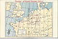
 Second world war europe 1941-1942 map de.png 1,090 × 1,000; 161 KB
-
 Barents 1942-it.svg 969 × 1,094; 158 KB
-
 Barents 1942.svg 964 × 1,088; 130 KB
-
 Ww2-europe-overview.gif 1,170 × 750; 177 KB
-
 Ww2summarymapeurope.gif 1,235 × 1,388; 204 KB
-
 Second world war europe 1943-1945 map de.png 1,088 × 998; 274 KB
-
 Atlantic wall may 1944 de.png 960 × 879; 664 KB
-
 266 стрелковая дивизия - этапы боевого пути.jpg 4,098 × 3,235; 4.62 MB
-
 2svitovavijnamapa.jpg 1,090 × 1,000; 659 KB
-
-
 Atlantic-Wall-ko.jpg 612 × 804; 197 KB
-
 Atlantic-Wall.jpg 612 × 804; 66 KB
-
 Bundesarchiv R 49 Bild-0705, Polen, Herkunft der Umsiedler, Karte.jpg 800 × 602; 274 KB
-
 Cambridge American Cemetery and Memorial - the Great Map.JPG 2,560 × 1,920; 984 KB
-
 Carte opération Herkules.png 325 × 351; 13 KB
-
 Civilian casualties in WWII.png 3,404 × 2,528; 959 KB
-
 Communications Zone boundaries April 1945.png 845 × 1,073; 332 KB
-
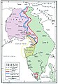 Confini Trieste-Istria2.jpg 1,471 × 2,130; 371 KB
-
 Convoy PQ-17 map 1942 (noms des navires)-fr.svg 970 × 1,095; 186 KB
-
 Convoy PQ-17 map 1942-fr.svg 970 × 1,095; 239 KB
-
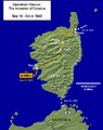 Corsica 1943.png 508 × 641; 109 KB
-
 Cost of World War II in Deaths.jpg 3,509 × 2,528; 897 KB
-
 Crimea within Nazi Germany.svg 450 × 456; 485 KB
-
 Deplac.Eur.C-O. 1939-1944.jpg 1,122 × 1,912; 717 KB
-
 Deplac.Eur.C-O. 1945-1953.jpg 1,128 × 1,910; 730 KB
-
 Die 'großzügigste Umsiedlungsaktion' with Poland superimposed, 1939.jpg 800 × 602; 206 KB
-
 Duitslandchurchill.png 998 × 896; 171 KB
-
 Duitslandroosevelt.png 998 × 896; 200 KB
-
 Durchmarschpläne IMG 1701.JPG 2,250 × 3,000; 1.31 MB
-
 Easterneurope10.jpg 1,256 × 956; 2.1 MB
-
 ETO Boundary changes 1942-1943.jpg 800 × 671; 87 KB
-
 Europ7.GIF 800 × 589; 44 KB
-
 Fliegerhorst Venlo Map 1944.jpg 1,312 × 1,424; 659 KB
-
 Führerbunker-ja.png 1,024 × 1,318; 268 KB
-
 Führerhauptquartiere Lage.svg 1,130 × 800; 740 KB
-
 G-5 Refugee Control Points - NARA - 100384839.jpg 7,424 × 4,214; 1.52 MB
-
 Gebietsveränderungen Balkan 1938-43.png 387 × 617; 298 KB
-
 Gen Okrug Belarus Administrative.png 660 × 980; 165 KB
-
 GreekItalian2ndItal.JPG 486 × 335; 48 KB
-
 GreekItalianGreekCounter.JPG 429 × 295; 43 KB
-
 Großdeutsches Reich-europe.png 1,829 × 1,647; 59 KB
-
 Großdeutsches Reich.png 1,829 × 1,647; 103 KB
-
 Hammond's map of The Mediterranean Europe and Northern Africa.jpg 16,144 × 12,306; 64.84 MB
-
 Hitler-Headquarters-Europe (Eagle's Nest inset).png 1,120 × 790; 628 KB
-
 Hitler-Headquarters-Europe.png 1,120 × 790; 473 KB
-
 Hopeakettu-suunnitelma.png 634 × 834; 26 KB
-
 Iceland invasion targets.png 485 × 343; 44 KB
-
 Independent State of Croatia location.png 1,088 × 998; 175 KB
-
 Invasion of Iceland ja.svg 726 × 550; 373 KB
-
 Invasion of Wehrmacht on Luxembourg 9may1940.jpg 351 × 377; 48 KB
-
 Invasion of Yugoslavia lines of attack Why We Fight no. 5(1 he).svg 445 × 321; 478 KB
-
 Irish and Scottish Bases.jpg 1,142 × 1,665; 265 KB
-
 Italian offensive Bourg Saint-Maurice-1940-IT.png 606 × 493; 156 KB
-
 Italian offensive Bourg Saint-Maurice-1940-IT.svg 606 × 493; 196 KB
-
 Italian offensive Bourg Saint-Maurice-1940.svg 606 × 493; 92 KB
-
 Italian offensive Mont Cenis-1940-IT.png 606 × 492; 210 KB
-
 Italian offensive Mont Cenis-1940.svg 606 × 492; 332 KB
-
 Italian offensive, Bourg Saint-Maurice.png 858 × 511; 58 KB
-
 Italian offensive, Mont Cenis.png 851 × 514; 70 KB
-
 Italienska områden 1939.PNG 326 × 332; 11 KB
-
 Jagarleveransen 1940-2-2.png 763 × 671; 108 KB
-
 Jagarleveransen 1940-2.png 763 × 671; 108 KB
-
 Jagarleveransen 1940.png 763 × 671; 98 KB
-
 Jan Karski missions en.png 3,507 × 2,480; 2.83 MB
-
 Jan Karski missions hu.png 3,507 × 2,480; 2.88 MB
-
 Jugoslavija i Evropa maj 1943.jpg 1,209 × 983; 1.07 MB
-
 Kapitulacija Italije i ustanak u okupiranoj Jugoslaviji 1943.png 1,984 × 1,455; 1.78 MB
-
 Kirkness-Petsamo offensive plan.jpg 873 × 600; 109 KB
-
 Kobryn.png 988 × 435; 115 KB
-
 Kuban-bruggenhoofd-sept-oct-1.jpg 1,618 × 1,208; 507 KB
-
 Kyst art batterier etter 2vk (Hordaland).jpeg 926 × 917; 289 KB
-
 Kyst art batterier etter 2vk.jpeg 3,677 × 4,619; 4.47 MB
-
 Latinaxis.png 450 × 456; 64 KB
-
 Location map of Weissruthenien-fr.svg 1,414 × 2,248; 134 KB
-
 LocationThirdReich.png 450 × 456; 44 KB
-
 Lotnictwo francja.png 8,562 × 10,132; 5.93 MB
-
 LuxembourgishFrenchoccupation1945-55-deutsch.jpg 370 × 466; 80 KB
-
 LuxembourgishFrenchoccupation1945-55-english.jpg 370 × 466; 75 KB
-
 Map of the Mediterranean.jpg 3,263 × 1,816; 761 KB
-

-
 Map.5.jpg 1,256 × 956; 193 KB
-
 Map950.jpg 5,130 × 4,838; 2.49 MB
-
 Mapa simplificado de europa en 1943.svg 854 × 744; 34 KB
-
 Marshall Plan.png 428 × 395; 84 KB
-
 Marshall Plan.svg 454 × 450; 410 KB
-
 Martian Defense Map - Anse de Vauville (South) - NARA - 100384359 (page 1).jpg 7,920 × 6,270; 4.18 MB
-
 Martian Defense Map - Anse de Vauville (South) - NARA - 100384359 (page 2).jpg 7,924 × 6,317; 2.72 MB
-
 Martian Defense Map - Barneville - NARA - 100384356 (page 1).jpg 7,952 × 6,258; 4.36 MB
-
 Martian Defense Map - Barneville - NARA - 100384356 (page 2).jpg 7,928 × 6,298; 2.9 MB
-
 Martian Defense Map - Havre de Portbail - NARA - 100384353 (page 1).jpg 7,940 × 6,257; 4.1 MB
-
 Martian Defense Map - Les Pieux - NARA - 100384368 (page 1).jpg 7,940 × 6,276; 4.32 MB
-
 Martian Defense Map - Lessay - NARA - 100384365 (page 1).jpg 7,952 × 6,250; 3.68 MB
-
 Martian Defense Map - Lessay - NARA - 100384365 (page 2).jpg 7,944 × 6,260; 2.38 MB
-
 Martian Defense Map - Periers - NARA - 100384362 (page 1).jpg 7,936 × 6,248; 3.8 MB
-
 Martian Defense Map - Periers - NARA - 100384362 (page 2).jpg 7,928 × 6,264; 3.01 MB
-
 Mediterranean Area Map.jpg 557 × 419; 64 KB
-
 MontenegrolocatormapWWII.png 250 × 115; 6 KB
-
 Nazi Germany 1942 location map.svg 800 × 683; 678 KB
-
 Newsmap - June 12, 1944.jpg 2,580 × 1,930; 1.6 MB
-
 Newsmap - May 7, 1945.jpg 2,579 × 1,920; 1.54 MB
-
 Niederlassungsstruktur des Einsatzstabes Reichsleiter Rosenberg (ERR).jpg 1,040 × 720; 420 KB
-
 OEF-reference-map.jpg 700 × 1,225; 99 KB
-
 Omaha Beach and Beach Maintenance Area.jpg 800 × 445; 76 KB
-
 Operation Jupiter 1942 map.png 1,185 × 947; 2.35 MB
-
 Order of battle - OB West, 6 June 1944.jpg 800 × 1,020; 170 KB
-
 Order of Battle Map France, Germany, and the Low Countries - NARA - 100385237.jpg 4,888 × 3,853; 1.39 MB
-
 Pacte Ribbentrop-Molotov-ar.svg 741 × 514; 293 KB
-
 Pacte Ribbentrop-Molotov.svg 741 × 514; 296 KB
-
 Petsamo 01.jpeg 1,508 × 1,533; 748 KB
-
 Plan of Mulberry A at Omaha Beach.jpg 800 × 677; 60 KB
-
 Planheft Schweiz.jpg 1,500 × 2,000; 2.48 MB
-
 Polskie dywizjony lotn anglia.png 1,900 × 2,738; 1.33 MB
-
 Pražská ofenzíva.jpg 560 × 559; 218 KB
-
 Progress wehrmacht lux May 1940.jpg 351 × 377; 63 KB
-
 Pursuit Across France - NARA - 100384821.jpg 10,816 × 6,613; 5.99 MB
-
 Radio de alcance das Torres de Arneiro.svg 3,784 × 2,544; 1.22 MB
-
 Radio de alcance dos Elektra-Sonne.png 2,402 × 1,626; 370 KB
-
 Railroad traffic disruptions in the area of Army Group Center, August 1943.jpg 1,100 × 816; 124 KB
-
 Railways in use by US forces east of Paris.jpg 1,000 × 1,302; 338 KB
-
 Regional Organization of SOS in the United Kingdom.jpg 800 × 1,032; 222 KB
-
 Reichskommissariat Ukraine (2).png 1,803 × 1,060; 816 KB
-
 Reichskommissariat-Ukraine.jpg 1,876 × 1,072; 1.13 MB
-
 ReichskommissariatUkraineMap (deutsch).png 1,803 × 1,060; 223 KB
-
 ReichskommissariatUkraineMap.png 3,000 × 2,352; 1.36 MB
-
 Ribbentrop-Molotov no legend.svg 718 × 669; 216 KB
-
 Ribbentrop-Molotov no.svg 1,052 × 744; 248 KB
-
 Ribbentrop-Molotov ro.svg 1,052 × 744; 248 KB
-
 Ribbentrop-Molotov-gr.svg 1,052 × 744; 253 KB
-
 Ribbentrop-Molotov-hebrew.svg 1,052 × 744; 226 KB
-
 Ribbentrop-Molotov-ru.svg 1,053 × 750; 28 KB
-
 Ribbentrop-Molotov.fi.svg 1,100 × 777; 251 KB
-
 Ribbentrop-Molotov.PNG 884 × 641; 63 KB
-
 Ribbentrop-molotov.png 1,258 × 878; 225 KB
-
 Ribbentrop-Molotov.svg 1,052 × 744; 377 KB
-
 Ribbentrop-Motov-no.svg 362 × 517; 59 KB
-
 Ribbentrop-Motov.svg 362 × 517; 62 KB
-
 Rom1940-1941.png 587 × 430; 30 KB
-
 Routes to Berlin.jpg 960 × 1,240; 472 KB
-
 Sala Holocausto, Genocidio y Crímenes contra la humanidad 07.jpg 3,000 × 2,000; 4 MB
-

-
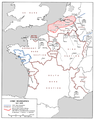
 Second world war europe 1935-1939 map de.png 958 × 875; 607 KB
-
 Second world war europe 1941-1942 map it.gif 1,090 × 1,000; 108 KB
-
 Second world war europe 1943-1945 map en.png 1,090 × 1,000; 264 KB
-
 Second world war europe 1943-1945 map HE.png 1,090 × 1,000; 298 KB
-
 Second world war europe 1943-1945 map it.gif 1,090 × 1,000; 129 KB
-
 Second world war europe 1943-1945 map pl.png 1,090 × 1,000; 454 KB
-
 Second world war europe 1943-1945 map pl2.png 1,090 × 1,000; 256 KB
-
 Segonda Guèrra Mondiala - Euròpa (1942-1945).png 1,166 × 671; 393 KB
-
 Segonda Guèrra Mondiala - Teatre europu - 1939-1942.png 3,000 × 3,001; 1.93 MB
-
 Segonda Guèrra Mondiala - Teatre europu - 1942-1945.png 3,000 × 3,004; 2.05 MB
-

-
 Skaalefjord.png 234 × 426; 37 KB
-
 Slowakei.1943.jpg 912 × 567; 735 KB
-
 Southern Shoulder Map.jpg 1,589 × 921; 461 KB
-
 SovietBlockade1940.jpg 1,452 × 1,052; 1.39 MB
-
 Stamp of USSR1973CPA4204.jpg 336 × 482; 75 KB
-
 Sudetenland.png 1,298 × 575; 27 KB
-
 Territorial victors against axis powers (Europe).png 6,519 × 4,126; 2.29 MB
-
 The North American Indian in the World War LOC 2016586524.tif 5,920 × 4,924; 83.4 MB
-
 The route to Sfakia.jpg 648 × 967; 406 KB
-
 The routes used by escape lines to help downed airmen escape Nazi-occupied Europe,.jpg 1,279 × 1,800; 231 KB
-
 Third Army Positions - 1 Sep 1944.png 1,830 × 1,451; 178 KB
-
 Three faces of Europe, 1950.jpg 1,095 × 1,550; 282 KB
-
 TomLubENG.png 2,880 × 2,880; 1.56 MB
-
 TomLubENG.svg 1,440 × 1,440; 8.08 MB
-
 TomLubPL.png 2,880 × 2,880; 1.56 MB
-
 TomLubPL.svg 1,440 × 1,440; 8.08 MB
-
 Tosse.png 955 × 789; 180 KB
-
 Tour map 1.jpg 960 × 731; 145 KB
-
 Tour map 2.jpg 960 × 731; 117 KB
-
 Transnistria administratie romaneasca.png 393 × 708; 11 KB
-
 Transnistria WW2.svg 1,300 × 3,200; 2.26 MB
-
 Travels of the 289th.jpg 10,295 × 7,442; 29.13 MB
-
 Truck routes in use by the US Army, 25 March - 8 May 1945.jpg 1,000 × 1,302; 238 KB
-
 Téli háború magyar önkénteseinek útja.png 960 × 1,000; 167 KB
-
 UK-NWE-Norway-2.jpg 800 × 526; 86 KB
-
 Unidentified Map - NARA - 100384845.jpg 5,836 × 7,289; 5.08 MB
-
 Unternehmen Barthold.gif 662 × 600; 82 KB
-
 Unternehmen Barthold.png 800 × 732; 112 KB
-
 Ustanak u Jugoslaviji i Evropa 1941.png 2,025 × 1,494; 1.89 MB
-
 Utah Beach and Beach Maintenance Area.jpg 800 × 1,032; 147 KB
-
 V-Weapon sites F B.png 1,588 × 1,046; 2.6 MB
-
 V-Weapon sites.png 2,775 × 1,284; 4.23 MB
-
 Village of Kesternich Map - 1944.jpg 734 × 439; 177 KB
-
 Volkhov bridgehead (south) - 1941.svg 943 × 607; 2.88 MB
-
 Western Europe WW2.png 357 × 328; 27 KB
-
 WWII Anti-Axis Greek Language Propaganda Maps - 06 - Germany reduced to its pre-war size.jpg 10,320 × 10,012; 17.28 MB
-
 WWII Campaign Map of 390 Anti-Aircraft Artillery (Automatic Weapons) Battalion.jpg 2,048 × 1,536; 622 KB
-
 WWII in Europe 1939-1941-blank.svg 1,258 × 1,075; 113 KB
-
 WWII in Europe 1939-1941-en.svg 1,256 × 1,259; 175 KB
-
 WWII in Europe 1939-1941-english.svg 612 × 792; 84 KB
-
 WWII in Europe 1939-1941-nv.svg 1,258 × 1,257; 495 KB
-
 WWII in Europe 1939-1941-pl.svg 1,256 × 1,259; 176 KB
-
 WWII Occupied Europe Blank Map.png 1,088 × 998; 200 KB
-
 WWII51 Gothic Line.jpg 1,780 × 1,375; 847 KB
-
 WWll европа map. jpg.jpg 1,200 × 1,001; 315 KB
-
-

-


-fr.svg)


.png)


.svg)


.jpeg)


.jpg)


_-_NARA_-_100384359_(page_1).jpg)
_-_NARA_-_100384359_(page_2).jpg)
.jpg)
.jpg)
.jpg)
.jpg)
.jpg)
.jpg)
.jpg)
.jpg)


.jpg)


.png)

.png)


.png)


.png)


_-_1941.svg)


_Battalion.jpg)


.jpg)
.jpg)
.jpg)