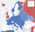
Category:Maps of Europe under Nazi occupation
Jump to navigation
Jump to search
European countries occupied by the military forces of Nazi Germany | |||||
| Upload media | |||||
| Instance of |
| ||||
|---|---|---|---|---|---|
| Start time |
| ||||
| End time |
| ||||
| |||||
Subcategories
This category has only the following subcategory.
C
Media in category "Maps of Europe under Nazi occupation"
The following 22 files are in this category, out of 22 total.
-
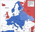
2svitovavijnamapa.jpg 1,090 × 1,000; 659 KB
-
Europa bajo la Alemania nazi.png 1,088 × 998; 261 KB
-
Europe under Nazi domination zh hans.png 1,088 × 998; 241 KB
-
Europe under Nazi domination zh hant.png 1,088 × 998; 237 KB
-
Europe under Nazi domination-el.png 1,088 × 998; 182 KB
-
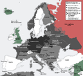
Europe under Nazi domination.png 1,088 × 998; 187 KB
-
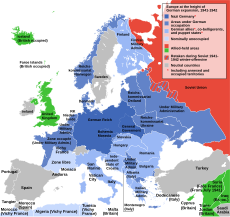
Europe, 1942.svg 519 × 488; 617 KB
-
Flag Map Of Germany Nazi (Version1).svg 512 × 518; 107 KB
-
Flag Map Of Germany Nazi (Version2).svg 512 × 511; 76 KB
-
Occupational Zones of Nazi Germany (Zoomed Wikipedia Map).png 1,425 × 625; 47 KB
-
Second world war europe 1941-1942 map de.png 1,090 × 1,000; 161 KB
-
Second world war europe 1941-1942 map it.gif 1,090 × 1,000; 108 KB
-
Sweden locator map 1942.svg 450 × 456; 481 KB
-
Victorious Nazi Germany.png 737 × 546; 185 KB
-
World War II in Europe, 1942 (Korean).svg 519 × 488; 671 KB
-
World War II in Europe, 1942 (no labels).svg 519 × 488; 620 KB
-
World War II in Europe, 1942-es.svg 519 × 488; 1.68 MB
-
World War II in Europe, 1942-pt.svg 519 × 488; 676 KB
-
World War II in Europe, 1942-vi.svg 519 × 488; 676 KB
-
World War II in Europe, 1942-zh.svg 519 × 488; 665 KB
-
World War II in Europe, 1942.svg 519 × 488; 674 KB
-
WWII Occupied Europe Blank Map.png 1,088 × 998; 200 KB
