Category:Maps of Wijk bij Duurstede
Jump to navigation
Jump to search
Wikimedia category | |||||
| Upload media | |||||
| Instance of | |||||
|---|---|---|---|---|---|
| Category combines topics | |||||
| Wijk bij Duurstede | |||||
municipality in the province of Utrecht, the Netherlands    .svg)  | |||||
| Spoken text audio | |||||
| Instance of |
| ||||
| Part of | |||||
| Location | Utrecht, Netherlands | ||||
| Capital | |||||
| Head of government |
| ||||
| Population |
| ||||
| Area |
| ||||
| Elevation above sea level |
| ||||
| official website | |||||
 | |||||
Subcategories
This category has only the following subcategory.
Media in category "Maps of Wijk bij Duurstede"
The following 25 files are in this category, out of 25 total.
-
 2013-WijkbijDuurstede.jpg 2,336 × 1,742; 2.38 MB
-
 BAG woonplaatsen - Gemeente Wijk bij Duurstede.png 2,419 × 2,419; 667 KB
-
 BRU.png 280 × 210; 17 KB
-
 Detail kaart.jpeg 1,580 × 828; 522 KB
-
 Dutch Municipality Wijk bij Duurstede 2006.png 280 × 130; 9 KB
-
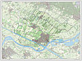
 Gem-WijkbijDuurstede-2014Q1.jpg 4,573 × 3,355; 6.29 MB
-
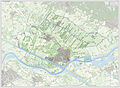
 Gem-WijkbijDuurstede-OpenTopo.jpg 5,332 × 3,790; 3.31 MB
-

-

-
 Kadastrale kaart - Wijk bij Duurstede - 20213003 - RCE.jpg 958 × 1,200; 261 KB
-
 Kolland en overlangbroek locatie.png 758 × 464; 343 KB
-
 LocatieWijkBijDuurstede.png 280 × 130; 9 KB
-
 Map - NL - Wijk bij Duurstede (2009).svg 625 × 575; 1.75 MB
-
 Map NL - Wijk bij Duurstede - Cothen.png 800 × 600; 9 KB
-
 Map NL - Wijk bij Duurstede - Langbroek.png 800 × 600; 9 KB
-
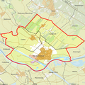
 NL - locator map municipality code GM0352 (2016).png 2,125 × 1,417; 643 KB
-

-
 Plattegrond - Wijk bij Duurstede - 20213007 - RCE.jpg 1,200 × 1,172; 444 KB
-

-

-
 Roetert 1830.jpeg 901 × 620; 97 KB
-
 Roetert current.jpeg 653 × 445; 85 KB
-
 Roetert overlay.jpeg 894 × 620; 155 KB
-
 Wijk bij Duurstede + 1649 Blaeu.jpg 473 × 750; 145 KB
-
 WijkbijDuurstede-centrum-OpenTopo.jpg 728 × 754; 468 KB


.svg)


.png)
_(14578447910).jpg)


