<nowiki>Category:Maps of Soest, Netherlands; categoría de Wikimedia; kategori Wikimedia; Wikimedia category; د ويکيمېډيا وېشنيزه; Vikimedya kategorisi; ویکیمیڈیا زمرہ; kategória projektov Wikimedia; категорія проєкту Вікімедіа; 维基媒体分类; Wikimedia-Kategorie; kategorie na projektech Wikimedia; Wikimedia-Kategorie; विकिपीडिया:श्रेणी; page de catégorie de Wikimedia; kategorija na Wikimediji; विकिपीडिया वर्ग; категорија на Викимедији; Wikimedia-Kategorie; Wikimedia-kategori; kategori Wikimédia; تصنيف ويكيميديا; pajenn rummata eus Wikimedia; Wikimedia:ကဏ္ဍခွဲခြင်း; 維基媒體分類; Wikimedia категориясы; categoría de Wikimedia; Wikimedia-Kategorie; Wikimedia-Kategorie; tudalen categori Wikimedia; Viciméid catagóir; ردهٔ ویکیپدیا; 维基媒体分类; Wikimedia-kategory; ვიკიპედია:კატეგორიზაცია; ウィキメディアのカテゴリ; categoria Wikimedia; تصنيف بتاع ويكيميديا; විකිමීඩියා ප්රභේද පිටුව; categoria Vicimediorum; विकिमीडिया श्रेणी; Wikimedia-luokka; Wikimedia category; விக்கிமீடியப் பகுப்பு; катэгорыя ў праекце Вікімэдыя; Викимедиа проектындагы төркем; catigurìa di nu pruggettu Wikimedia; หน้าหมวดหมู่วิกิมีเดีย; Wikimedia:Kategorija; Wikimedia-Kategorie; Wikimedia:Klassys; категория на Уикимедия; categorie a unui proiect Wikimedia; 維基媒體分類; Wikimedia-kategori; kawan Wikimèdia; 維基媒體分類; 위키미디어 분류; Wikimedia-bólkur; kategorio en Vikimedio; kategori Wikimedia; Wikimedia:Ronnaghys; উইকিমিডিয়া বিষয়শ্রেণী; kategori Wikimedia; 维基媒体分类; וויקימעדיע קאַטעגאָריע; kategorija w projektach Wikimedije; thể loại Wikimedia; Wikimedia projekta kategorija; kategoria ti Wikimedia; categoria de um projeto da Wikimedia; Wikimedia category; категорияд Ангилал; Wikimedia-kategori; kategori Wikimedia; پۆلی ویکیمیدیا; Wikimedia category; Vikimédia ñemohenda; Wikimédia-kategória; વિકિપીડિયા શ્રેણી; Wikimediako kategoria; категория в проекте Викимедиа; Wikimedia-Kategorie; катэгорыя ў праекце Вікімедыя; Wikimedia-kategorie; Wîkîmediya:Kategorî; विकिमिडिया श्रेणी; Wikimedia-Kategorie; קטגוריה במיזמי ויקימדיה; Викимедиа проектындагы төркем; kategoria w projekcie Wikimedia; विकिमिडिया श्रेणी; κατηγορία εγχειρημάτων Wikimedia; Wikimedia-kategoriija; гурӯҳи Викимедиа; 維基媒體分類; categoría de Wikimedia; 維基媒體分類; categoria di un progetto Wikimedia; Wikimedia-categorie; 维基媒体分类; categurìa 'e nu pruggette Wikimedia; Wikimedia kategooria; Վիքիմեդիայի նախագծի կատեգորիա; Vikipidiya:Shopni; kategorya ng Wikimedia; гурӯҳи Викимедиа; ẹ̀ka Wikimedia; Викимедиина категорија; categoria de um projeto da Wikimedia; kategorija na Wikimediji; Викимедиа категорияһы; tumbung Wikimedia; Wikimedia-kategorie; kategorija Wikimedie; Wikimedia proyektındağı törkem; categoria de Wikimedia; Kategoriya ning Wikimedia; kategori Wikimedia; jamii ya Wikimedia; വിക്കിമീഡിയ വർഗ്ഗം; Wikimedia-categorie; kategori Wikimedia; Wikimedia-categorie; زمرو:وڪيپيڊيا زمرا بندي; kategori e Wikimedias; categoría de Wikimedia; Wikimedia-kategori; 维基媒体分类; guruhi Vikimedia</nowiki>
Subcategories
This category has only the following subcategory.

.jpg)

.svg)
.png)


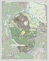 2013-Soest.jpg 1,675 × 2,077; 2.15 MB
 2015BirktTopo.jpg 1,600 × 1,200; 1.4 MB
 2015BirktTopoHoogte.jpg 1,550 × 1,006; 1.19 MB
 BAG woonplaatsen - Gemeente Soest.png 2,419 × 2,419; 730 KB
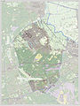 Gem-Soest-2014Q1.jpg 3,126 × 4,155; 5.76 MB
 Gem-Soest-OpenTopo.jpg 3,507 × 4,781; 3.47 MB
 Gemeente Soest.jpg 1,206 × 804; 127 KB
 LocatieSoest.png 280 × 130; 9 KB
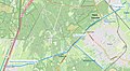 Maartensdijk-Baarn Praamgracht tracee OSM.jpg 1,333 × 736; 360 KB
 Map - NL - Soest (2009).svg 625 × 575; 2.35 MB
 OSM Wijken van Soest.png 1,095 × 729; 473 KB
 Plattegrond of situatie tekening - Soest - 20023505 - RCE.jpg 1,200 × 801; 354 KB
 Soest Kaart van percelen (gemarkeerd A tm W) gelegen in de Birkt.jpg 600 × 461; 82 KB
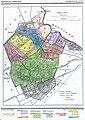 Soest, Gemeenteatlas van Nederland.jpg 2,484 × 3,508; 2.35 MB
 Soest-topografie.jpg 1,931 × 2,086; 1.61 MB
 Spoorlijn Den Dolder-Baarn.PNG 1,218 × 817; 56 KB


.svg)


_toebehorende_aan_het_klooster_Mari%C3%ABnhof_en_gelegen_in_De_Birkt.jpg)
_gelegen_in_de_Birkt.jpg)


