Category:Maps of Vlissingen
Jump to navigation
Jump to search
Wikimedia category | |||||
| Upload media | |||||
| Instance of | |||||
|---|---|---|---|---|---|
| Category combines topics | |||||
| Vlissingen | |||||
municipality in Zeeland, the Netherlands    .png)  | |||||
| Instance of |
| ||||
| Location | Zeeland, Netherlands | ||||
| Located in or next to body of water | |||||
| Visitor center | |||||
| Capital | |||||
| Head of government |
| ||||
| Inception |
| ||||
| Population |
| ||||
| Area |
| ||||
| Elevation above sea level |
| ||||
| Replaces |
| ||||
| official website | |||||
 | |||||
Subcategories
This category has the following 2 subcategories, out of 2 total.
O
- Old maps of Vlissingen (57 F)
Media in category "Maps of Vlissingen"
The following 23 files are in this category, out of 23 total.
-
 129-Uncle Beach.jpg 2,953 × 497; 308 KB
-
 2013-Vlissingen.jpg 2,692 × 1,440; 1.56 MB
-
 Admiralty Chart No 120 Wester Schelde Flushing to Antwerp, Published 1968.jpg 18,433 × 11,214; 71.98 MB
-
 Admiralty Chart No 1872 Dunkerque to Flushing, Published 1962, New Edition 1966.jpg 16,407 × 11,260; 26.33 MB
-
 BAG woonplaatsen - Gemeente Vlissingen.png 2,419 × 2,419; 666 KB
-
 Gem-Vlissingen-2014Q1.jpg 8,487 × 4,189; 7 MB
-
 Gem-Vlissingen-OpenTopo.jpg 6,344 × 2,900; 3.11 MB
-

-
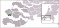 LocatieVlissingen.png 270 × 130; 11 KB
-
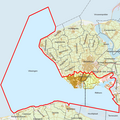
 Map - NL - Vlissingen (2009).svg 625 × 575; 1.75 MB
-
 Map - NL - Vlissingen - Wijk 01 Binnenstad.svg 625 × 575; 11 KB
-
 Map - NL - Vlissingen - Wijk 02 Middengebied.svg 625 × 575; 11 KB
-
 Map - NL - Vlissingen - Wijk 03 Paauwenburg-Westduin.svg 625 × 575; 11 KB
-
 Map - NL - Vlissingen - Wijk 04 Lammerenburg.svg 625 × 575; 11 KB
-
 Map - NL - Vlissingen - Wijk 05 Oost-Souburg.svg 625 × 575; 11 KB
-
 Map - NL - Vlissingen - Wijk 06 Ritthem en omgeving.svg 625 × 575; 11 KB
-
 Map - NL - Vlissingen - Wijk 07 Binnen- en Buitenhavens.svg 625 × 575; 11 KB
-
 Map - NL - Vlissingen - Wijk 08 Sloegebied.svg 625 × 575; 11 KB
-
 Vlissingen kadaster section D 1811-1832.jpg 11,872 × 7,974; 17.1 MB
-
 Vlissingen-centrum-OpenTopo.jpg 3,986 × 3,560; 3.77 MB
-
 Vlissingen-plaats-OpenTopo.jpg 1,868 × 1,543; 1.42 MB
-
 Vlissingen-stad-2014Q1.jpg 1,868 × 1,543; 1.3 MB
-
 Vlissingen-topografie.jpg 1,748 × 1,306; 1.26 MB


.svg)


