Category:Maps of Kapelle
Jump to navigation
Jump to search
| NO WIKIDATA ID FOUND! Search for Maps of Kapelle on Wikidata | |
| Upload media |
Subcategories
This category has the following 2 subcategories, out of 2 total.
O
- Old maps of Kapelle (11 F)
Media in category "Maps of Kapelle"
The following 9 files are in this category, out of 9 total.
-
 2013-Kapelle.jpg 1,619 × 1,935; 1.54 MB
-
 BAG woonplaatsen - Gemeente Kapelle.png 2,419 × 2,419; 530 KB
-
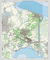
 Gem-Kapelle-2014Q1.jpg 3,148 × 4,153; 4.35 MB
-
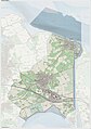 Gem-Kapelle-OpenTopo.jpg 2,975 × 4,230; 1.34 MB
-
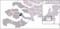 LocatieKapelle.png 270 × 130; 11 KB
-
 Map - NL - Kapelle (2009).svg 625 × 575; 922 KB
-
 Map - NL - Kapelle - Wijk 00 Kapelle.svg 625 × 575; 6 KB
-
 Map - NL - Municipality code 0678 (2009).svg 300 × 160; 530 KB
-
 NL - locator map municipality code GM0678 (2016).png 2,125 × 1,417; 313 KB


.svg)

.svg)
.png)