Category:Maps of Tyrol (state)
Jump to navigation
Jump to search
States of Austria:  Burgenland ·
  Carinthia ·
  Lower Austria ·
  Salzburg ·
  Styria ·
  Tyrol ·
  Upper Austria ·
  Vienna ·
  Vorarlberg
Wikimedia category | |||||
| Upload media | |||||
| Instance of | |||||
|---|---|---|---|---|---|
| Category combines topics | |||||
| Tyrol | |||||
federal state in western Austria | |||||
| Instance of | |||||
| Named after | |||||
| Location | Austria | ||||
| Capital | |||||
| Legislative body | |||||
| Anthem | |||||
| Head of government |
| ||||
| Has part(s) |
| ||||
| Population |
| ||||
| Area |
| ||||
| Different from | |||||
| official website | |||||
 | |||||
Deutsch: Karten von Tirol (Bundesland).
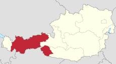
English: Maps of Tyrol (state)
Use the appropriate category for maps showing all or a large part of Tyrol. See subcategories for smaller areas:
| If the map shows | Category to use |
|---|---|
| Tyrol on a recently created map | Category:Maps of Tyrol (state) or its subcategories |
| Tyrol on a map created more than 70 years ago | Category:Old maps of Tyrol (state) or its subcategories |
| the history of Tyrol on a recently created map | Category:Maps of the history of Tyrol (state) or its subcategories |
| the history of Tyrol on a map created more than 70 years ago | Category:Old maps of the history of Tyrol (state) or its subcategories |
Subcategories
This category has the following 12 subcategories, out of 12 total.
!
- SVG maps of Tyrol (state) (22 F)
C
D
E
F
- Floor plans of Tyrol (state) (13 F)
I
L
- Maps of Leutasch (9 F)
Media in category "Maps of Tyrol (state)"
The following 23 files are in this category, out of 23 total.
-
Achenkirch und Achenkirch-Achensee Franziszeischen Kataster 1855.jpg 4,990 × 18,055; 24.4 MB
-
After Action Report - Imst - NARA - 100384929.jpg 10,800 × 7,758; 9.12 MB
-
AUT — Tirol — Bezirk Reutte — Hahntennjochstrasse (Schild).jpg 3,648 × 2,736; 4.65 MB
-
Bistuemer oesterreich innsbruck.png 299 × 154; 12 KB
-
Bistuemer oesterreich salzburg.png 299 × 154; 12 KB
-
Felbertauern-alagut.png 1,165 × 939; 892 KB
-
Ferdinand Löwls geolog. Karte vom Großglockner mit Ergänzungen (Bearbeitung).png 1,524 × 1,110; 238 KB
-
GemeindenTirol.svg 2,364 × 1,316; 151 KB
-
Grenzverlauf A-Tirol-Vorarlberg.png 2,821 × 2,954; 8.4 MB
-
Kaisertal Karte 2.jpg 3,648 × 2,736; 2.76 MB
-
Karte Samoarhütte 1875.png 1,242 × 1,365; 2.49 MB
-
Karte vom Kaisergebirge.jpg 6,570 × 4,993; 9.48 MB
-
Landkarte Tiefenbachklamm.jpg 4,000 × 3,000; 6.02 MB
-
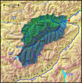
OetztalerAche Inn catchment.png 1,736 × 2,596; 7.65 MB
-
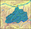
Sanna Inn catchment.png 1,600 × 1,621; 4.39 MB
-
Schlegeissperre 03 Übersicht.JPG 1,411 × 990; 149 KB
-
Seen um Kufstein und Kiefersfelden.jpg 940 × 1,025; 438 KB
-
Sill Inn catchment.png 1,200 × 1,154; 2.47 MB
-
Skelettkarte der Kalkkögel.png 1,849 × 2,781; 430 KB
-
Stuibenfall Tirol008.JPG 3,264 × 4,928; 5.57 MB
-
Tirol.png 2,057 × 1,455; 687 KB
-
TirolerGemeinden2023.svg 2,104 × 1,200; 162 KB
-
Ziller Inn catchment.png 1,684 × 1,896; 5.68 MB


