Category:Maps of Tonkin
Jump to navigation
Jump to search

English: This category is for old maps of Tonkin, the French protectorate in Northern Vietnam that was established in the 1880s as a part of French Indochina and lost in the 1950s. Earlier maps or later maps that only show North Vietnam under this name (Tonquin/Tumkin/Tongking etc.), should also be categorized as Maps of Tonkin, but if all of Vietnam (Tonkin + Annam/Cochinchina/Quinan) is shown, these maps should rather be categorized as "maps of Vietnam".
Subcategories
This category has the following 9 subcategories, out of 9 total.
Media in category "Maps of Tonkin"
The following 6 files are in this category, out of 6 total.
-
 Old map of Vietnam.jpg 3,024 × 2,179; 1.99 MB
-
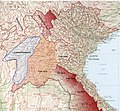
 LocationTonkin.svg 1,000 × 500; 860 KB
-
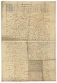 Calque d'une carte annamite des environs de Thái Nguyên (Tonkin) - btv1b53121034g.jpg 11,849 × 17,220; 28.29 MB
-
 Carte du tonkin 12019.jpg 3,252 × 2,392; 1.16 MB
-
 Tonkin1893.jpg 1,900 × 1,758; 1.39 MB
-
 Vietnam, 1895, late Nguyễn dynasty.png 1,657 × 3,680; 475 KB


_-_btv1b53121034g.jpg)


