Category:Maps of Thuin
Jump to navigation
Jump to search
Media in category "Maps of Thuin"
The following 13 files are in this category, out of 13 total.
-
 Biercée Thuin Hainaut Belgium Map.svg 761 × 747; 1.55 MB
-
 Biesme-sous-Thuin Thuin Hainaut Belgium Map.svg 761 × 747; 1.55 MB
-
 Donstiennes Thuin Hainaut Belgium Map.svg 761 × 747; 1.55 MB
-
 Gozée Thuin Hainaut Belgium Map.svg 761 × 747; 1.55 MB
-
 Leers-et-Fosteau Thuin Hainaut Belgium Map.svg 761 × 747; 1.55 MB
-
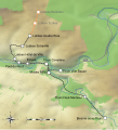 Lobbes-Thuin tramway relief map.svg 1,052 × 1,154; 571 KB
-
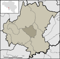
 Ragnies Thuin Hainaut Belgium Map.svg 761 × 747; 1.55 MB
-
 Sections Thuin Hainaut Belgium Map.svg 761 × 747; 1.64 MB
-
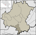
 Thuillies Thuin Hainaut Belgium Map.svg 761 × 747; 1.55 MB
-
 Thuin Hainaut Belgium Map.png 355 × 278; 6 KB
-
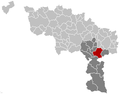
 Thuin Hainaut Belgium Map.svg 889 × 692; 2.96 MB
-
 Thuin Thuin Hainaut Belgium Map.svg 761 × 747; 1.55 MB
-
 ThuinLocatie.PNG 355 × 278; 8 KB


