Category:Maps of Sino-Indian border dispute
Jump to navigation
Jump to search
border dispute between China and India  | |||||
| Upload media | |||||
| Instance of | |||||
|---|---|---|---|---|---|
| Location |
| ||||
| |||||
Subcategories
This category has the following 9 subcategories, out of 9 total.
A
C
- Maps of Chang Chenmo Valley (27 F)
D
- Maps of the Demchok sector (27 F)
- Maps of Depsang Plains (13 F)
G
- Maps of Galwan Valley (13 F)
M
- Maps of Doklam (11 F)
- McMahon Line (41 F)
P
- Maps of Pangong Tso (39 F)
S
- Maps of Spanggur Lake (1 F)
Media in category "Maps of Sino-Indian border dispute"
The following 11 files are in this category, out of 11 total.
-

-

-
 1947 India showing Provinces, States and Districts by Survey of India.jpg 7,867 × 6,491; 3.93 MB
-
 Alignment Official Pakistan map 1962.jpg 600 × 616; 59 KB
-

-
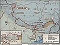 China India CIA map border disputes.jpg 652 × 490; 93 KB
-
 India Pakistan China Disputed Areas Map.png 1,500 × 1,564; 508 KB
-
 Kashmir region 2004.jpg 1,579 × 1,567; 1.71 MB
-

-
 Nyamjang Chu and Tawang Chu rivers mapped by Morshead and Bailey, 1913.jpg 1,121 × 1,837; 934 KB
-
 Xikang province in 1950 CIA map of Tibet.jpg 1,991 × 1,305; 733 KB


.jpg)


.jpg)

