Category:Maps of Chang Chenmo Valley
Jump to navigation
Jump to search
Media in category "Maps of Chang Chenmo Valley"
The following 27 files are in this category, out of 27 total.
-
 1916 Survey map India and Adjascent Countries - Ladakh.jpg 5,017 × 6,042; 3.25 MB
-
 1945 Ladakh-Tibet Boundary Dokpo Karpo from Tibetan Precis.jpg 3,323 × 2,808; 782 KB
-
 1947 ROC claim line in Ladakh.jpg 644 × 619; 172 KB
-
 1960 Northern Frontier of India by SOI.jpg 4,384 × 3,252; 1.02 MB
-
 1963 Colombo proposals in Galwan and Chang Chenmo valleys.jpg 1,467 × 1,205; 511 KB
-
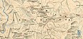
 Changchenmo-Valley-map-by-Frederic-Drew.jpg 1,399 × 769; 465 KB
-
 Changchenmo-Valley-map-by-US-Army-Map-Service.jpg 3,449 × 1,765; 3.08 MB
-
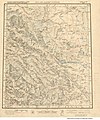
 Changchenmo-Valley-map-Survey-of-India-1916.jpg 1,518 × 703; 436 KB
-
 Djammou-Kachmir from Asie 1 to 1,000,000. flle 36N-78E.jpg 9,000 × 7,128; 10.52 MB
-
 Galwan River claim lines (1962).jpg 1,715 × 1,093; 545 KB
-
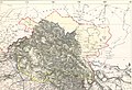 Jammu and Kashmir in 1888 Survey of India map.jpg 5,113 × 3,513; 5.64 MB
-
 Jammu and Kashmir in 1947 Political Map of India.jpg 1,385 × 1,015; 501 KB
-
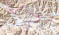
 Jianan-pass-LSIB-border.jpg 1,109 × 658; 79 KB
-
 Johnson-journey-ilchi1865-mapa.jpg 1,688 × 1,600; 495 KB
-
 Kongka Pass claim lines (1962).jpg 1,449 × 1,219; 558 KB
-
 Kongka-La-snapshot-from-earthworks-stanford-edu-Gogra-Hot-Springs.jpg 1,038 × 646; 63 KB
-
 Kongka-Pass-area.jpg 1,452 × 875; 605 KB
-

-
 Ladakh-Garhwal-1863.jpg 2,340 × 1,700; 1.38 MB
-
 Map India and Pakistan 1-250,000 Tile NI 44-5 Shyok.jpg 5,000 × 3,798; 3.51 MB
-

-
 Pangong-Tso-from-Edward-Weller-map-1863.jpg 605 × 382; 109 KB
-

-
 Trade-routes-via-Pangong-and-Changchenmo-Douglas-Forsythe-1878.jpg 1,010 × 667; 229 KB
-
 Txu-pclmaps-oclc-181831961-52-j-lower-chang-chenmo-1875.jpg 3,401 × 4,689; 2.71 MB
-
 Txu-pclmaps-oclc-181831961-52-n-lanak-la-1928.jpg 3,636 × 5,030; 1.99 MB
-
 Txu-pclmaps-oclc-181831961-52-n-m-lanak-la-1875.jpg 3,394 × 4,945; 2.74 MB


.jpg)


.jpg)


_(14796674583)_(cropped).jpg)


.jpg)

_(14796674583).jpg)


