Category:Maps of Santa Cruz County, Arizona
Jump to navigation
Jump to search
Wikimedia category | |||||
| Upload media | |||||
| Instance of | |||||
|---|---|---|---|---|---|
| Category combines topics | |||||
| Santa Cruz County | |||||
county in Arizona, United States | |||||
| Instance of | |||||
| Named after | |||||
| Location | Arizona | ||||
| Capital | |||||
| Inception |
| ||||
| Highest point |
| ||||
| Population |
| ||||
| Area |
| ||||
| Elevation above sea level |
| ||||
| Different from | |||||
| official website | |||||
 | |||||
Subcategories
This category has only the following subcategory.
Media in category "Maps of Santa Cruz County, Arizona"
The following 42 files are in this category, out of 42 total.
-
Map of Arizona highlighting Santa Cruz County.svg 893 × 1,099; 260 KB
-
Santa Cruz County Incorporated and Unincorporated areas.svg 850 × 450; 41 KB
-
Arizona 1860.jpg 890 × 1,002; 104 KB
-
AZ-08.png 633 × 378; 23 KB
-
Harshaw Area USGS Topographical Map.JPG 1,200 × 800; 1.62 MB
-
Harshaw Quadrangle USGS Topographical Map.gif 3,000 × 3,645; 1.37 MB
-
Joſeph de Vrrutia.jpg 175 × 40; 94 KB
-
Las Cienegas National Conservation Area (26632538161).jpg 5,241 × 3,494; 6.79 MB
-
PATAGONIA LAKE EAST END (6916057017).jpg 1,280 × 892; 1.16 MB
-
Pima County, Arizona circa 1883 (Harshaw).jpg 1,263 × 598; 873 KB
-
Ruby AZ topo.jpg 1,233 × 744; 219 KB
-
Southeast Cochise County 1880.png 1,647 × 982; 3.99 MB
-
Urritiamapoftubac.jpg 3,036 × 2,322; 4.7 MB
-
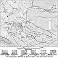
USGS Greaterville Map 1910.jpg 1,123 × 1,124; 878 KB
-
USGS Map of Santa Rita and Patagonia Mts 1910.jpg 928 × 588; 280 KB
-
AZMap-doton-Amado.png 260 × 300; 22 KB
-
AZMap-doton-Rio Rico Northeast.png 260 × 300; 22 KB
-
AZMap-doton-Rio Rico Northwest.png 260 × 300; 22 KB
-
AZMap-doton-Rio Rico Southeast.png 260 × 300; 22 KB
-
AZMap-doton-Rio Rico Southwest.png 260 × 300; 22 KB
-
AZMap-doton-Tumacacori-Carmen.png 260 × 300; 22 KB


