Category:Maps of Saône-et-Loire by Chabe01
Jump to navigation
Jump to search
Media in category "Maps of Saône-et-Loire by Chabe01"
The following 94 files are in this category, out of 94 total.
-
 Canton Mâcon-1.svg 1,250 × 1,900; 3.05 MB
-
 Canton Mâcon-2.svg 1,250 × 1,900; 3.05 MB
-
 Canton Saône-et-Loire Autun-1.svg 1,000 × 787; 49 KB
-
 Canton Saône-et-Loire Autun-2.svg 1,000 × 787; 49 KB
-
 Canton Saône-et-Loire Blanzy.svg 1,000 × 787; 49 KB
-
 Canton Saône-et-Loire Chagny.svg 1,000 × 787; 49 KB
-
 Canton Saône-et-Loire Chalon-sur-Saône-1.svg 1,000 × 787; 49 KB
-
 Canton Saône-et-Loire Chalon-sur-Saône-2.svg 1,000 × 787; 49 KB
-
 Canton Saône-et-Loire Chalon-sur-Saône-3.svg 1,000 × 787; 49 KB
-
 Canton Saône-et-Loire Charolles.svg 1,000 × 787; 49 KB
-
 Canton Saône-et-Loire Chauffailles.svg 1,000 × 787; 49 KB
-
 Canton Saône-et-Loire Cluny.svg 1,000 × 787; 49 KB
-
 Canton Saône-et-Loire Cuiseaux.svg 1,000 × 787; 49 KB
-
 Canton Saône-et-Loire Digoin.svg 1,000 × 787; 49 KB
-
 Canton Saône-et-Loire Gergy.svg 1,000 × 787; 49 KB
-
 Canton Saône-et-Loire Givry.svg 1,000 × 787; 49 KB
-
 Canton Saône-et-Loire Gueugnon.svg 1,000 × 787; 49 KB
-
 Canton Saône-et-Loire Hurigny.svg 1,000 × 787; 49 KB
-
 Canton Saône-et-Loire La Chapelle-de-Guinchay.svg 1,000 × 787; 49 KB
-
 Canton Saône-et-Loire Le Creusot-1.svg 1,000 × 787; 49 KB
-
 Canton Saône-et-Loire Le Creusot-2.svg 1,000 × 787; 49 KB
-
 Canton Saône-et-Loire Louhans.svg 1,000 × 787; 49 KB
-
 Canton Saône-et-Loire Montceau-les-Mines.svg 1,000 × 787; 49 KB
-
 Canton Saône-et-Loire Mâcon-1.svg 1,000 × 787; 49 KB
-
 Canton Saône-et-Loire Mâcon-2.svg 1,000 × 787; 49 KB
-
 Canton Saône-et-Loire Ouroux-sur-Saône.svg 1,000 × 787; 49 KB
-
 Canton Saône-et-Loire Paray-le-Monial.svg 1,000 × 787; 49 KB
-
 Canton Saône-et-Loire Pierre-de-Bresse.svg 1,000 × 787; 49 KB
-
 Canton Saône-et-Loire Saint-Rémy.svg 1,000 × 787; 49 KB
-
 Canton Saône-et-Loire Saint-Vallier.svg 1,000 × 787; 49 KB
-
 Canton Saône-et-Loire Tournus.svg 1,000 × 787; 49 KB
-
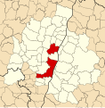
 Cantons Sâone-et-Loire.svg 1,000 × 787; 51 KB
-
 Carte Aire Urbaine Mâcon.svg 750 × 750; 1.24 MB
-
 Carte Loché.svg 1,584 × 1,131; 798 KB
-
 Carte Sancé.svg 1,103 × 970; 3.15 MB
-
 Charnay-lès-Mâcon - Saône-et-Loire - Mâcon.svg 1,020 × 810; 671 KB
-
 Communes Aire ubaine Macon.svg 520 × 530; 881 KB
-
 Géolocalisation Autun.svg 900 × 1,000; 226 KB
-
 Géolocalisation Chalon-sur-Saône.svg 940 × 1,030; 126 KB
-
 Géolocalisation Cluny.svg 1,110 × 980; 151 KB
-
 Géolocalisation Mâcon.svg 1,250 × 1,900; 117 KB
-
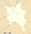
 Géolocalisation Saône-et-Loire.svg 782 × 623; 42 KB
-
 Géolocalisation Tournus.svg 855 × 970; 128 KB
-
 Ligne A TRéMA.svg 1,563 × 2,575; 5.53 MB
-
 Ligne B TRéMA.svg 2,063 × 1,904; 8.87 MB
-
 Ligne C TRéMA.svg 1,353 × 2,056; 6.54 MB
-
 Ligne D TRéMA.svg 1,841 × 3,296; 4.67 MB
-
 Loché - Routes.svg 1,584 × 1,131; 645 KB
-
 Loché Mâcon.svg 1,250 × 1,900; 3.06 MB
-
 Marcigny - Saône-et-Loire - Charolles.svg 1,020 × 810; 272 KB
-
 Marcigny - Saône-et-Loire - Marcigny.svg 1,020 × 810; 271 KB
-
 Marcigny - Saône-et-Loire - Paray-le-Monial.svg 1,020 × 810; 271 KB
-
 Marcigny Prieuré XVIIe siècle.svg 785 × 486; 1.42 MB
-
 Mâcon - Saône-et-Loire - Mâcon.svg 1,020 × 810; 272 KB
-
 Mâcon Centre.svg 1,438 × 1,196; 5.74 MB
-
 Mâcon Nord.svg 1,116 × 923; 5.57 MB
-
 Mâcon Sud.svg 2,350 × 1,615; 5.09 MB
-
 Plan Mâcon.svg 1,250 × 1,900; 118 KB
-
 Plan Trema Ligne A.svg 2,705 × 740; 121 KB
-
 Plan Trema Ligne B.svg 2,240 × 825; 108 KB
-
 Plan Trema Ligne C.svg 3,425 × 740; 129 KB
-
 Plan Trema Ligne E.svg 2,000 × 930; 76 KB
-
 Plan Trema Ligne G.svg 2,580 × 1,020; 104 KB
-
 Plan Trema Ligne Navette.svg 795 × 1,035; 79 KB
-
 Saint-Vincent-Bragny limites avant 1972 (1).svg 530 × 505; 113 KB
-
 Sancé - Territoire.svg 1,103 × 970; 2.85 MB
-
 Sennecé Mâcon.svg 1,250 × 1,900; 3.06 MB
-
 St Jean Priche - Carte.svg 1,250 × 950; 1.43 MB
-
 St Jean Priche - Territoire.svg 1,250 × 950; 589 KB
-
 St Jean Priche Mâcon.svg 1,250 × 1,900; 3.06 MB
-
 Terrioire Viré Fleurville après 1969 1.svg 950 × 730; 22 KB
-
 Terrioire Viré Fleurville après 1969 2.svg 950 × 730; 37 KB
-
 Territoire Bragny-en-Charollais.svg 505 × 670; 52 KB
-
 Territoire Fleurville depuis 1969.svg 420 × 470; 10 KB
-
 Territoire Navour Grosne.svg 790 × 670; 63 KB
-
 Territoire Saint-Romain-des-Îles.svg 540 × 610; 6 KB
-
 Territoire Saint-Symphorien-d'Ancelles après 1975 (1).svg 780 × 770; 71 KB
-
 Territoire Saint-Symphorien-d'Ancelles après 1975 (2).svg 780 × 770; 12 KB
-
 Territoire Saint-Symphorien-d'Ancelles avant 1975.svg 730 × 480; 9 KB
-
 Territoire Saint-Vincent-Bragny limites avant 1972 (2).svg 530 × 505; 64 KB
-
 Territoire Saint-Vincent-lès-Bragny.svg 590 × 490; 38 KB
-
 Territoire Viré avant 1969.svg 540 × 730; 16 KB
-
 Territoire Viré Vérizet-Fleurville avant 1952 1.svg 950 × 730; 24 KB
-
 Territoire Viré Vérizet-Fleurville avant 1952 2.svg 950 × 730; 49 KB
-
 Territoire Viré-Vérizet 1.svg 715 × 730; 36 KB
-
 Territoire Viré-Vérizet 2.svg 715 × 730; 23 KB
-
 Territoire Viré-Vérizet-Fleurville (1952-1969) 1.svg 950 × 730; 29 KB
-
 Territoire Viré-Vérizet-Fleurville (1952-1969) 2.svg 950 × 730; 52 KB
-
 Territoire Vérizet (1952-1969).svg 420 × 640; 14 KB
-
 Territoire Vérizet-Fleurville 1.svg 675 × 650; 16 KB
-
 Territoire Vérizet-Fleurville 2.svg 675 × 650; 20 KB
-
 Territoire Vérizet-Fleurville 3.svg 675 × 650; 39 KB
-
 Varennes-lès-Mâcon - Saône-et-Loire - Mâcon.svg 1,020 × 810; 671 KB
-
 Voies Marcigny.svg 1,369 × 1,215; 1.24 MB


.svg)


.svg)
.svg)

.svg)


_1.svg)
_2.svg)
.svg)


