Category:Maps by Chabe01
Jump to navigation
Jump to search
Maps by Chabe01
Subcategories
This category has the following 6 subcategories, out of 6 total.
A
I
J
S
T
Media in category "Maps by Chabe01"
The following 17 files are in this category, out of 17 total.
-
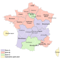
 Carte France DISP.svg 2,000 × 1,922; 1.07 MB
-
 Carte Ligne 1 Léman Express.svg 750 × 562; 255 KB
-
 Carte Ligne 2 Léman Express.svg 577 × 820; 208 KB
-
 Carte Ligne 3 Léman Express.svg 984 × 844; 243 KB
-
 Carte Ligne 4 Léman Express.svg 562 × 600; 152 KB
-
 Carte Ligne 5 Léman Express.svg 750 × 403; 59 KB
-
 Carte Ligne 6 Léman Express.svg 689 × 445; 73 KB
-
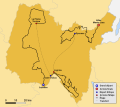 Carte Parcours Tour de l'Ain 2023.svg 715 × 635; 136 KB
-
 Carte Territoire Augès avant 1973.svg 741 × 666; 39 KB
-
 Carte Évolution Territoire Commune Saint-Étienne (Loire).svg 1,112 × 704; 233 KB
-
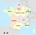
 Départements et provinces de France.svg 588 × 550; 351 KB
-
 France (Communes).svg 1,000 × 960; 15.4 MB
-
 France (Régions).svg 1,000 × 960; 16.39 MB
-
 Noyant Villages.svg 800 × 900; 1.31 MB
-
 Plan Genève RER 2011.svg 1,363 × 388; 23 KB
-
 Territoire Bressuire.svg 630 × 560; 153 KB
-
 Zones vacances France 2016.svg 2,000 × 1,922; 979 KB


.svg)

.svg)
.svg)


