Category:Maps of Remscheid
Jump to navigation
Jump to search
Wikimedia category | |||||
| Upload media | |||||
| Instance of | |||||
|---|---|---|---|---|---|
| Category combines topics | |||||
| Remscheid | |||||
city in North Rhine-Westphalia, Germany | |||||
| Instance of |
| ||||
| Location | Düsseldorf Government Region, North Rhine-Westphalia, Germany | ||||
| Located in or next to body of water | |||||
| Head of government |
| ||||
| Population |
| ||||
| Area |
| ||||
| Elevation above sea level |
| ||||
| official website | |||||
 | |||||
Subcategories
This category has only the following subcategory.
O
Media in category "Maps of Remscheid"
The following 67 files are in this category, out of 67 total.
-
101 RS-Mitte.png 1,527 × 1,169; 169 KB
-
102 Nordstadt.png 1,527 × 1,169; 168 KB
-
103 Altstadt.png 1,527 × 1,169; 169 KB
-
104 Stachelhausen.png 1,527 × 1,169; 169 KB
-
105 Blumental.png 1,527 × 1,169; 169 KB
-
106 Honsberg.png 1,527 × 1,169; 169 KB
-
107 Stadtpark.png 1,527 × 1,169; 170 KB
-
108 Scheid.png 1,527 × 1,169; 168 KB
-
201 Hasten.png 1,527 × 1,169; 168 KB
-
202 Kratzberg.png 1,527 × 1,169; 168 KB
-
2020 Remscheid City Council election.svg 1,214 × 727; 358 KB
-
203 Haddenbach.png 1,527 × 1,169; 167 KB
-
204 Schöne Aussicht.png 1,527 × 1,169; 169 KB
-
205 Hölterfeld.png 1,527 × 1,169; 168 KB
-
301 Zentralpunkt.png 1,527 × 1,169; 169 KB
-
302 Neuenkamp.png 1,527 × 1,169; 168 KB
-
303 Fichtenhöhe.png 1,527 × 1,169; 168 KB
-
304 Wüstenhagen.png 1,527 × 1,169; 169 KB
-
305 Bökerhöhe.png 1,527 × 1,169; 169 KB
-
306 Mixsiepen.png 1,527 × 1,169; 168 KB
-
307 Struck.gif 1,527 × 1,169; 154 KB
-
309 Bliedinghausen.gif 1,527 × 1,169; 155 KB
-
310 Ehringhausen.gif 1,527 × 1,169; 156 KB
-
401 Morsbach.png 1,527 × 1,169; 167 KB
-
402 Vieringhausen.png 1,527 × 1,169; 167 KB
-
403 Kremenholl.png 1,527 × 1,169; 169 KB
-
404 Reinshagen.png 1,527 × 1,169; 168 KB
-
405 Westhausen.png 1,527 × 1,169; 167 KB
-
501 Lennep Altstadt.png 1,527 × 1,169; 170 KB
-
502 Lennep Nord.png 1,527 × 1,169; 169 KB
-
503 Stadtgarten.png 1,527 × 1,169; 167 KB
-
504 Lennep Neustadt.png 1,527 × 1,169; 169 KB
-
505 Lennep West.png 1,527 × 1,169; 168 KB
-
506 Hackenberg.png 1,527 × 1,169; 168 KB
-
507 Henkelshof.png 1,527 × 1,169; 168 KB
-
508 Hasenberg.png 1,527 × 1,169; 168 KB
-
509 Trecknase.png 1,527 × 1,169; 169 KB
-
510 Grenzwall.png 1,527 × 1,169; 168 KB
-
511 Engelsburg.png 1,527 × 1,169; 167 KB
-
512 Bergisch Born Ost.png 1,527 × 1,169; 168 KB
-
513 Bergisch Born West.png 1,527 × 1,169; 168 KB
-
601 Lüttringhausen Mitte.png 1,527 × 1,169; 169 KB
-
602 Klausen.png 1,527 × 1,169; 168 KB
-
603 Großhülsberg.png 1,527 × 1,169; 168 KB
-
604 Garschagen.png 1,527 × 1,169; 169 KB
-
605 Schmittenbusch.png 1,527 × 1,169; 168 KB
-
606 Stursberg.png 1,527 × 1,169; 167 KB
-
607 Dörrenberg.png 1,527 × 1,169; 167 KB
-
608 Goldenberg.png 1,527 × 1,169; 168 KB
-
609 Lüttringhausen West.png 1,527 × 1,169; 167 KB
-
Alt-Remscheid.png 1,527 × 1,169; 401 KB
-
Karte von Remscheid.gif 507 × 342; 8 KB
-
Lage der kreisfreien Stadt Remscheid in Deutschland.png 176 × 234; 3 KB
-
Lage der Stadt Remscheid in Deutschland.png 188 × 235; 5 KB
-
Locator map RS in Germany.svg 1,075 × 1,273; 637 KB
-
Locator map RS in North Rhine-Westphalia.svg 657 × 656; 479 KB
-
North rhine w RS.png 593 × 585; 69 KB
-
North rhine w RS.svg 660 × 660; 221 KB
-
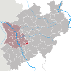
NRW RB Düsseldorf RS.svg 592 × 584; 246 KB
-
Remscheid Lennep - Thüringsberg 02 ies.jpg 5,616 × 3,744; 15.82 MB
-
Remscheid-Lennep.png 1,527 × 1,169; 403 KB
-
Solingen–Wuppertal01.png 759 × 628; 213 KB
-
Stadtgliederung Remscheid (SVG Version).svg 1,488 × 1,052; 197 KB
-
Stadtgliederung Remscheid.gif 1,486 × 1,129; 88 KB
-
Stadtteile Alt Remscheid.png 641 × 933; 179 KB
-
Stadtteile Lennep.png 785 × 982; 198 KB
-
Stadtteile Remscheid Sued.png 859 × 737; 213 KB


