Category:Maps of Overijssel
Jump to navigation
Jump to search
Maps of Overijssel.
For external maps see also maps of the Netherlands.
Provinces of the Netherlands: Drenthe · Flevoland · Friesland · Gelderland · Groningen · Limburg · North Brabant · North Holland · Overijssel · South Holland · Utrecht · Zeeland
Wikimedia category | |||||
| Upload media | |||||
| Instance of | |||||
|---|---|---|---|---|---|
| Category combines topics | |||||
| Overijssel | |||||
province of the Netherlands     | |||||
| Instance of | |||||
| Named after | |||||
| Location | Netherlands | ||||
| Capital | |||||
| Anthem |
| ||||
| Head of government | |||||
| Highest point | |||||
| Population |
| ||||
| Area |
| ||||
| official website | |||||
 | |||||
Subcategories
This category has the following 32 subcategories, out of 32 total.
- OpenStreetMap maps of Overijssel (16 F)
- Road maps of Overijssel (96 F)
*
A
B
D
E
H
K
L
M
O
R
S
T
W
Z
Media in category "Maps of Overijssel"
The following 75 files are in this category, out of 75 total.
-
 2009-Basisbeeld-Provincie04-Overijssel.jpg 955 × 828; 354 KB
-
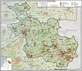
 2010-NL-P04-Overijssel-positiekaart-gemgrenzen.jpg 1,033 × 969; 279 KB
-
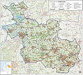
 2010-NL-P04-Overijssel-positiekaart-gemnamen.jpg 1,033 × 969; 287 KB
-
 2010-P04-Overijssel-basisbeeld.jpg 955 × 828; 394 KB
-
 2010-P04-Overijssel-outline-tr.png 833 × 768; 75 KB
-
 2011-P04-Overijssel-b54.jpg 1,396 × 1,259; 1.08 MB
-
 2012-P04-OV-basis.jpg 1,275 × 1,150; 1.16 MB
-
 2012-R04-IJ-basis.jpg 1,044 × 1,099; 920 KB
-
 2013-P04-OV-b.jpg 1,507 × 1,359; 1.45 MB
-
 2013-Top33-Sallandseheuvelrug.jpg 1,816 × 2,329; 2.41 MB
-
 2013-Top33-Wiki-P04-Overijssel.jpg 10,900 × 10,143; 66.6 MB
-
 2015-P04-Overijssel-o.png 1,318 × 1,214; 687 KB
-
 2015-P04-Overijssel.jpg 2,465 × 2,261; 2.91 MB
-
 2015-R04-IJsselland.jpg 1,878 × 1,978; 1.94 MB
-
 2015-R05-Twente.jpg 1,618 × 1,350; 1.21 MB
-
 2016-P04-Overijssel-o.png 1,471 × 1,354; 731 KB
-
 2016-P04-Overijssel.jpg 1,964 × 1,783; 1.58 MB
-
 2017-P04-Overijssel.jpg 1,967 × 1,818; 2.22 MB
-
 2018-P04-Overijssel.jpg 2,426 × 2,248; 1.09 MB
-
 Engbertsdijksvenen-natuur-OpenTopo.jpg 1,552 × 2,808; 1.71 MB
-
 Kaart DSM.png 661 × 427; 188 KB
-
 Kaart Overijssel genummerd.jpg 270 × 240; 17 KB
-
 Kaart Overijssel.jpg 270 × 240; 23 KB
-
 Kaart Regio Zwolle.jpg 1,400 × 990; 249 KB
-

-

-

-
 LocatieProvOverijssel.png 534 × 616; 50 KB
-
 Locator Prince-Bishopric of Utrecht (1350).svg 2,818 × 3,608; 427 KB
-
 Low Countries Locator Prince-Bischopric Utrecht.svg 1,550 × 2,000; 381 KB
-
 Natura 2000 - Aamsveen.jpg 483 × 478; 57 KB
-
 Natura2000 - Achter de Voort, Agelerbroek & Voltherbroek.png 2,016 × 2,267; 324 KB
-
 Natura2000 - Bergvennen & Brecklenkampse Veld.png 2,016 × 2,267; 205 KB
-
 Natura2000 - Boddenbroek.png 2,016 × 2,267; 133 KB
-
 Natura2000 - Boetelerveld.png 2,016 × 2,267; 142 KB
-
 Natura2000 - Borkeld.png 2,016 × 2,267; 228 KB
-
 Natura2000 - Buurserzand & Haaksbergerveen.png 2,016 × 2,267; 429 KB
-
 Natura2000 - De Wieden.png 2,016 × 2,267; 599 KB
-
 Natura2000 - Dinkelland.png 2,016 × 2,267; 703 KB
-
 Natura2000 - Engbertsdijksvenen.png 2,016 × 2,267; 311 KB
-
 Natura2000 - Ketelmeer & Vossemeer.png 2,016 × 2,267; 341 KB
-
 Natura2000 - Landgoederen Oldenzaal.png 2,016 × 2,267; 549 KB
-
 Natura2000 - Lemselermaten.png 2,016 × 2,267; 127 KB
-
 Natura2000 - Lonnekermeer.png 2,016 × 2,267; 263 KB
-
 Natura2000 - Olde Maten & Veerslootslanden.png 2,016 × 2,267; 174 KB
-
 Natura2000 - Sallandse Heuvelrug.png 2,016 × 2,267; 339 KB
-
 Natura2000 - Springendal & Dal van de Mosbeek.png 2,016 × 2,267; 462 KB
-
 Natura2000 - Uiterwaarden IJssel.png 2,016 × 2,267; 1.6 MB
-
 Natura2000 - Uiterwaarden Zwarte Water en Vecht.png 2,016 × 2,267; 419 KB
-
 Natura2000 - Vecht- en Beneden-Reggegebied.png 2,016 × 2,267; 574 KB
-
 Natura2000 - Weerribben.png 2,016 × 2,267; 511 KB
-
 Natura2000 - Wierdense Veld.png 2,016 × 2,267; 171 KB
-
 Natura2000 - Witte Veen.png 2,016 × 2,267; 247 KB
-
 Natura2000 - Zwarte Meer.png 2,016 × 2,267; 160 KB
-
 Netherlands Overijssel location map.svg 948 × 1,000; 203 KB
-
 Overijssel 6.40634E 52.40561N.jpg 1,280 × 958; 388 KB
-
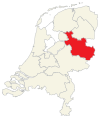
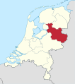 Overijssel in the Netherlands 2019.svg 888 × 1,001; 160 KB
-
 Overijssel in the Netherlands.svg 888 × 1,001; 145 KB
-
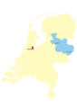
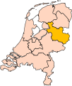 Overijssel position.svg 200 × 236; 157 KB
-
 Overijssel-Position.png 200 × 235; 23 KB
-
 Overijssel.GIF 201 × 291; 4 KB
-
 Overijssel.png 842 × 1,191; 48 KB
-
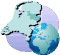
 OverijsselNetherlandsGlobe.png 500 × 500; 234 KB
-
 OverijsselNetherlandsGlobeGrey.png 500 × 500; 89 KB
-
 Overijssels Havezatenpad.jpg 855 × 691; 223 KB
-
 OverijsselTranparency.GIF 201 × 291; 5 KB
-
 P Provinces of the Netherlands - Overijssel.gif 424 × 388; 37 KB
-
 P04-OV-positiekaart2-gemlabels.png 1,324 × 1,232; 1.11 MB
-
 Prov-Overijssel-OpenTopo.jpg 2,092 × 1,950; 704 KB
-
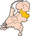
 Provinces of the Netherlands - Overijssel.svg 595 × 710; 67 KB
-
 Provincie Overijssel.gif 810 × 750; 382 KB
-
 Provincie-04-Overijssel-2009.png 810 × 750; 443 KB
-
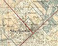 Slagharen in 1914.jpg 392 × 309; 40 KB
-
 StrekenProvincieOverijssel.png 270 × 240; 10 KB
-
 VonDemTeutschenLand.jpg 606 × 346; 62 KB


.svg)


