Category:Maps of Flevoland
Appearance
Provinces of the Netherlands: Drenthe · Flevoland · Friesland · Gelderland · Groningen · Limburg · North Brabant · North Holland · Overijssel · South Holland · Utrecht · Zeeland
Wikimedia category | |||||
| Upload media | |||||
| Instance of | |||||
|---|---|---|---|---|---|
| Category combines topics | |||||
| Flevoland | |||||
province of the Netherlands | |||||
| Instance of | |||||
| Named after |
| ||||
| Location | Netherlands | ||||
| Located in or next to body of water |
| ||||
| Capital | |||||
| Anthem |
| ||||
| Head of government |
| ||||
| Inception |
| ||||
| Population |
| ||||
| Area |
| ||||
| official website | |||||
 | |||||
Subcategories
This category has the following 8 subcategories, out of 8 total.
Media in category "Maps of Flevoland"
The following 44 files are in this category, out of 44 total.
-
- Topografische kaarten - 30034211 - RCE.jpg 3,426 × 4,401; 1.37 MB
-
2009-Basisbeeld-Provincie12-Flevoland.jpg 783 × 799; 270 KB
-
2009-Risicokaart-Regio25-Flevoland.jpg 628 × 654; 161 KB
-
2010-NL-P12-Flevoland-positiekaart-gemgrenzen.jpg 809 × 822; 175 KB
-
2010-NL-P12-Flevoland-positiekaart-gemnamen.jpg 809 × 822; 181 KB
-
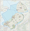
2010-P12-Flevoland-basisbeeld.jpg 783 × 799; 297 KB
-
2010-P12-Flevoland-outline-tr.png 608 × 626; 38 KB
-
2010-R25-Flevoland-basisbeeld.jpg 783 × 799; 299 KB
-
2011-P12-Flevoland-b54.jpg 1,132 × 1,102; 736 KB
-
2012-P12-FL-basis.jpg 1,031 × 1,004; 690 KB
-
2012-R25-FL-basis.jpg 1,062 × 1,046; 754 KB
-
2013-P12-FL-b.jpg 1,218 × 1,186; 951 KB
-
2013-R25-FL-b.jpg 1,255 × 1,237; 950 KB
-
2013-Top33-R25-Flevoland.jpg 8,269 × 8,317; 31.28 MB
-
2015-P12-Flevoland.jpg 1,871 × 1,838; 1.43 MB
-
2015-R25-Flevoland.jpg 1,997 × 1,965; 1.69 MB
-
2016-P12-Flevoland-o.png 1,079 × 1,103; 283 KB
-
2016-P12-Flevoland.jpg 1,436 × 1,460; 694 KB
-
2017-P12-Flevoland.jpg 1,454 × 1,504; 1.11 MB
-
2018-P12-Flevoland.jpg 1,836 × 1,870; 554 KB
-
Flevoland in the Netherlands 2019.svg 888 × 1,001; 160 KB
-
Flevoland in the Netherlands.svg 888 × 1,001; 143 KB
-
Flevoland position.svg 200 × 236; 157 KB
-
Flevoland-Position.png 200 × 235; 23 KB
-
Flevoland.GIF 201 × 291; 4 KB
-
Flevoland.png 842 × 1,191; 43 KB
-
Flevolandmap.png 908 × 1,020; 337 KB
-
FlevolandNetherlandsGlobe.png 500 × 500; 233 KB
-
FlevolandNetherlandsGlobeGrey.png 500 × 500; 89 KB
-
FlevolandTranparency.GIF 201 × 291; 5 KB
-
Land Art Flevoland overzichtskaartje.jpg 5,472 × 3,648; 6.41 MB
-
LocatieProvFlevoland.png 534 × 616; 49 KB
-
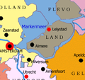
Markermeer map.png 257 × 241; 36 KB
-
Ontwerp Afsluiting Zuiderzee en Droogmaking Cornelis Lely 1891-1892.jpg 7,399 × 10,806; 17.73 MB
-
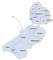
P12-FL-positiekaart2-gemlabels.png 1,042 × 1,042; 1.62 MB
-
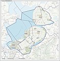
Prov-Flevoland-OpenTopo.jpg 1,620 × 1,647; 374 KB
-
Provinces of the Netherlands - Flevoland.gif 424 × 388; 36 KB
-
Provinces of the Netherlands - Flevoland.svg 595 × 710; 67 KB
-
Provincie Flevoland.gif 654 × 673; 263 KB
-
Provincie-12-Flevoland-2009.png 654 × 673; 295 KB
-
Regio-25-Flevoland-2009.png 654 × 692; 272 KB
-
StrekenProvincieFlevoland.png 113 × 127; 1,015 bytes
-
Zuiderzeewerke.png 500 × 595; 28 KB
-
Zuiderzeewerken-NL.png 500 × 592; 74 KB


