Category:Maps of O'Higgins Region
Jump to navigation
Jump to search
Regions of Chile: Arica y Parinacota · Tarapacá · Antofagasta · Atacama · Coquimbo · Valparaíso · Santiago · O'Higgins · Maule · Ñuble · Biobío · Araucanía · Los Ríos · Los Lagos · Aysén · Magallanes
Subcategories
This category has the following 2 subcategories, out of 2 total.
M
Media in category "Maps of O'Higgins Region"
The following 17 files are in this category, out of 17 total.
-
 Mapa loc O'Higgins.svg 400 × 600; 1.15 MB
-
 060-atlasagro.png 1,052 × 744; 664 KB
-
 Cardenal Caro Province map - numbered.svg 186 × 334; 39 KB
-
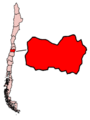 ChileRegionOHiggins.png 300 × 400; 10 KB
-
 Glaciares Region de OHiggins.png 1,046 × 663; 444 KB
-
 Libertador general Bernardo O'Higgins location map.svg 125 × 100; 980 KB
-
 Mapa de capillas marchiguanas.jpg 646 × 577; 224 KB
-
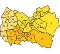 O'Higgins Comunas.png 400 × 360; 50 KB
-
 Plano de Rancagua.png 2,000 × 1,979; 392 KB
-
 Provincias de O'Higgins.svg 600 × 500; 192 KB
-
 Rancagua location.jpg 890 × 515; 88 KB
-
 Region VI.png 71 × 271; 11 KB
-
 Rioteno cuenca.jpg 1,280 × 933; 712 KB
-
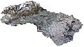 Valle Cachapoal Chile - panoramio.jpg 6,290 × 3,500; 2.99 MB
-
 VI O'Higgins.svg 600 × 500; 228 KB
-
 Volcan-tinguiririca hu.svg 815 × 1,029; 302 KB
-
 Volcan-tinguiririca.svg 815 × 1,029; 227 KB


