Category:Maps of Araucanía Region
Jump to navigation
Jump to search
Regions of Chile: Arica y Parinacota · Tarapacá · Antofagasta · Atacama · Coquimbo · Valparaíso · Santiago · O'Higgins · Maule · Ñuble · Biobío · Araucanía · Los Ríos · Los Lagos · Aysén · Magallanes
Wikimedia category | |||||
| Upload media | |||||
| Instance of | |||||
|---|---|---|---|---|---|
| |||||
Subcategories
This category has the following 2 subcategories, out of 2 total.
Media in category "Maps of Araucanía Region"
The following 27 files are in this category, out of 27 total.
-
 IX Araucanía.svg 500 × 474; 564 KB
-
 Mapa loc Araucanía.svg 400 × 600; 1.16 MB
-
 2011 Temuco earthquake.jpg 612 × 721; 105 KB
-
 2021 Consulta ciudadana Araucanía.svg 400 × 385; 200 KB
-
 Araucaniablanca.jpg 400 × 387; 24 KB
-
 Araucanía Comunas.png 400 × 387; 52 KB
-
 Araucanía Entrada en Renaico.jpg 1,224 × 1,632; 472 KB
-
 Araucanía Entrada en Renaico.png 1,791 × 1,693; 5.6 MB
-
 Araucanía Municipalities.svg 1,819 × 1,708; 352 KB
-
 Carta de colonización 1916.JPG 1,989 × 2,738; 1.38 MB
-
 Chile region IX.png 71 × 271; 10 KB
-
 Chile.bahía-de-arauco.png 1,955 × 933; 4.14 MB
-
 ChileRegionAraucania.png 300 × 400; 11 KB
-
 Grantemuco.PNG 979 × 659; 19 KB
-
 Jog-cañete.jpg 1,476 × 1,392; 790 KB
-
 La Araucanía location map.svg 170 × 155; 989 KB
-
 LocationKingdomAraucania.svg 1,000 × 500; 987 KB
-
 Mapa No. 30. Provincia de Cautin-7930037.jpg 5,370 × 4,132; 3.14 MB
-
 Mulchen-los-angeles-angol-collipulli.jpg 1,408 × 1,679; 1.03 MB
-
 PLANO DE BARROS ARANA.jpg 1,313 × 768; 106 KB
-
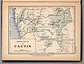
 Provincia de Cautín - Geografía Descriptiva República de Chile - Enrique Espinoza 1897.jpg 2,837 × 2,047; 1.39 MB
-
 Provincias de Araucanía.svg 500 × 474; 565 KB
-
 Reino de la Araucanía y la Patagonia.jpg 520 × 1,004; 107 KB
-
 Señalización vial.JPG 3,872 × 2,592; 4.3 MB
-
 Traiguén.png 1,650 × 1,275; 155 KB
-
 Txu-oclc-224571178-sj18-08.jpg 5,209 × 3,954; 8.82 MB
-
 Txu-oclc-224571178-sj18-12.jpg 5,226 × 3,966; 8.37 MB


