Category:Maps of Mount Adams (Washington)
Jump to navigation
Jump to search
Wikimedia category | |||||
| Upload media | |||||
| Instance of | |||||
|---|---|---|---|---|---|
| Category combines topics | |||||
| Mount Adams | |||||
Southern Washington stratovolcano in the Cascade Volcanic Arc | |||||
| Instance of | |||||
| Named after | |||||
| Made from material | |||||
| Location |
| ||||
| Mountain range | |||||
| Topographic prominence |
| ||||
| Elevation above sea level |
| ||||
 | |||||
Subcategories
This category has only the following subcategory.
Media in category "Maps of Mount Adams (Washington)"
The following 20 files are in this category, out of 20 total.
-
Cascade eruptions in the last 4000 years-fr.png 767 × 515; 71 KB
-
Indian Heaven Volcanic Field and Mount Adams Volcanic Vicinity Digital Relief Map.png 1,152 × 1,548; 2.77 MB
-
Mount Adams (Washington) Map 1901 Reid.jpg 1,421 × 1,933; 755 KB
-
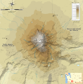
Mount Adams bedrock topographic map-fr.svg 785 × 799; 728 KB
-
Mount Adams Midway High Lakes Area Visitor Map.gif 1,530 × 1,288; 554 KB
-
Mount Adams Midway High Lakes Area Visitor Map.png 1,530 × 1,288; 2.76 MB
-
Mount Adams Region topographic map-fr 2.svg 513 × 669; 3.03 MB
-
Mount Adams Region topographic map-fr.svg 751 × 870; 3.02 MB
-
Mount Adams Relief Map, SRTM-1.jpg 1,600 × 1,200; 1.45 MB
-
Mount Adams topographic map-fr.svg 785 × 799; 964 KB
-
Rainier Adams Hood Saint Helens Comparison -vertical.png 588 × 2,375; 1.67 MB
-
Rainier Adams Hood Saint Helens Comparison-fr.svg 2,356 × 588; 13.21 MB
-
Rainier Adams Hood Saint Helens Comparison.png 2,356 × 588; 1.69 MB
-
Rainier Shasta Adams Hood Saint Helens Comparison.png 2,957 × 588; 1.93 MB
-
Rainier Shasta Adams Hood Saint Helens Comparison.svg 2,957 × 588; 10.66 MB
-
South Washington Cascade Range topographic map-fr.svg 720 × 722; 6.86 MB
-
South Washington protected areas map-fr.svg 720 × 722; 6.86 MB
-
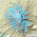
USGS Glaciers of Mount Adams Map.gif 2,310 × 2,310; 1.05 MB
-
USGS Glaciers of Mount Adams Map.png 2,310 × 2,310; 2.09 MB
-
Yakima Fold Belt map.jpg 641 × 456; 150 KB


