Category:Maps of Mannheim
Jump to navigation
Jump to search
Urban districts (cities): Baden-Baden · Freiburg · Heidelberg · Heilbronn · Karlsruhe · Mannheim · Pforzheim · Stuttgart · Ulm
Use the appropriate category for maps showing all or a large part of Mannheim. See subcategories for smaller areas:
| If the map shows | Category to use |
|---|---|
| Mannheim on a recently created map | Category:Maps of Mannheim or its subcategories |
| Mannheim on a map created more than 70 years ago | Category:Old maps of Mannheim or its subcategories |
| the history of Mannheim on a recently created map | Category:Maps of the history of Mannheim or its subcategories |
| the history of Mannheim on a map created more than 70 years ago | Category:Old maps of the history of Mannheim or its subcategories |
Wikimedia category | |||||
| Upload media | |||||
| Instance of | |||||
|---|---|---|---|---|---|
| Category combines topics | |||||
| Mannheim | |||||
city in Baden-Württemberg, Germany | |||||
| Pronunciation audio | |||||
| Instance of |
| ||||
| Part of | |||||
| Location |
| ||||
| Located in or next to body of water | |||||
| Visitor center |
| ||||
| Head of government | |||||
| Has part(s) | |||||
| Significant event |
| ||||
| Population |
| ||||
| Area |
| ||||
| Elevation above sea level |
| ||||
| Different from | |||||
| official website | |||||
 | |||||
Subcategories
This category has the following 9 subcategories, out of 9 total.
E
S
Media in category "Maps of Mannheim"
The following 27 files are in this category, out of 27 total.
-
17 Stadtbezirke 2020.png 1,654 × 2,338; 269 KB
-
38 Stadtteile 2020.png 1,654 × 2,338; 321 KB
-
Baden-Württemberg MA.svg 1,058 × 1,161; 188 KB
-
BWahlkreis 275.svg 480 × 540; 87 KB
-
Campusplan Universitätsklinikum Mannheim.JPG 4,222 × 2,781; 3.5 MB
-
Karte Luisenpark Mannheim.png 3,000 × 2,528; 2.36 MB
-
Karte Seilbahn Mannheim.png 3,000 × 2,707; 6.04 MB
-
Karte Verkehrswege Großraum Mannheim.png 3,250 × 3,347; 8.14 MB
-
Locator map MA in Baden-Württemberg.svg 1,058 × 1,161; 278 KB
-
Locator map MA in Germany.svg 1,075 × 1,273; 578 KB
-
MA in Baden-Württemberg.svg 753 × 868; 159 KB
-
Mannheim in Germany.png 188 × 235; 5 KB
-
Mannheim Innenstadtschema.svg 400 × 400; 17 KB
-
Mannheim Lageplan.JPG 506 × 599; 25 KB
-
Mannheim stadtteile.png 389 × 600; 91 KB
-
Mannheim-Friedrichsplatz.png 550 × 576; 18 KB
-
Mannheim-Hafen.png 432 × 582; 23 KB
-
Mannheim-Luisenpark.png 1,024 × 762; 1.53 MB
-
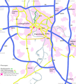
Mannheim-Strassenverkehr.png 560 × 616; 160 KB
-
Mannheim-Uniklinikum.jpg 1,024 × 729; 459 KB
-
NBS-Mannheim-Stuttgart.png 459 × 567; 162 KB
-
Rhein-Neckar-Dreieck'.png 612 × 413; 71 KB
-
Rhein-Neckar-Dreieck.png 973 × 589; 223 KB
-
Schautafel Übersichtskarte Dossenwald.JPG 2,736 × 3,648; 4.27 MB
-
UMM-Schautafel2013.JPG 3,157 × 2,053; 627 KB
-
WeinheimOEG Bahnhof.jpg 850 × 567; 248 KB
-
ZI Lageplan Mannheim 2018.jpg 1,760 × 1,673; 855 KB


