Category:Maps of Landkreis Konstanz
Jump to navigation
Jump to search
Urban districts (cities): Baden-Baden · Freiburg · Heidelberg · Heilbronn · Karlsruhe · Mannheim · Pforzheim · Stuttgart · Ulm
Use the appropriate category for maps showing all or a large part of Konstanz. See subcategories for smaller areas:
| If the map shows | Category to use |
|---|---|
| Konstanz on a recently created map | Category:Maps of Landkreis Konstanz or its subcategories |
| Konstanz on a map created more than 70 years ago | Category:Old maps of Landkreis Konstanz or its subcategories |
| the history of Konstanz on a recently created map | Category:Maps of the history of Landkreis Konstanz or its subcategories |
| the history of Konstanz on a map created more than 70 years ago | Category:Old maps of the history of Landkreis Konstanz or its subcategories |
Subcategories
This category has the following 2 subcategories, out of 2 total.
Media in category "Maps of Landkreis Konstanz"
The following 2 files are in this category, out of 2 total.
-
 Carte-évasion-Cioma-Schönhaus.jpg 848 × 1,018; 153 KB
-
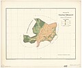 D-BW-KN - Mühlingen - Gallmannsweil - Karte der Gemarkung.jpg 2,000 × 1,671; 173 KB

