Category:Maps of Little Bighorn Battlefield National Monument
Jump to navigation
Jump to search
US national monuments: Agate Fossil Beds · Aztec Ruins · Bandelier · Cabrillo · Canyon de Chelly · Cedar Breaks · Colorado · Craters of the Moon · Devils Postpile · Devils Tower · Dinosaur · Effigy Mounds · Florissant Fossil Beds · Gila Cliff Dwellings · Hovenweep · Jewel Cave · John Day Fossil Beds · Lava Beds · Little Bighorn Battlefield · Montezuma Castle · Muir Woods · Natural Bridges · Organ Pipe Cactus · Rainbow Bridge · Statue of Liberty · Sunset Crater Volcano · Timpanogos Cave · Walnut Canyon · Wupatki ·
English: Maps of Little Bighorn Battlefield National Monument
Wikimedia category | |||||
| Upload media | |||||
| Instance of | |||||
|---|---|---|---|---|---|
| Category combines topics | |||||
| Little Bighorn Battlefield National Monument | |||||
American National Monument  | |||||
| Instance of |
| ||||
| Location | Big Horn County, Montana | ||||
| Operator | |||||
| Maintained by | |||||
| Heritage designation |
| ||||
| IUCN protected areas category | |||||
| Inception |
| ||||
| Area |
| ||||
| Visitors per year |
| ||||
| official website | |||||
 | |||||
Media in category "Maps of Little Bighorn Battlefield National Monument"
The following 7 files are in this category, out of 7 total.
-
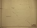 Custer Battlefield 1908 (bottom).jpg 4,032 × 3,024; 3.61 MB
-
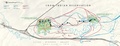
 Custer's route over Little Bighorn battlefield.jpg 1,024 × 696; 359 KB
-
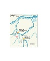
 NPS little-bighorn-battle-map.jpg 868 × 1,059; 225 KB
-
 NPS little-bighorn-battle-map.pdf 370 × 454; 73 KB
-
 NPS little-bighorn-geologic-map.jpg 3,180 × 3,628; 2.01 MB
-
 NPS little-bighorn-map.jpg 3,869 × 1,486; 1.12 MB
-
 NPS little-bighorn-map.pdf 2,522 × 968; 5.92 MB
.jpg)


