Category:Maps of Jewel Cave National Monument
Jump to navigation
Jump to search
US national monuments: Agate Fossil Beds · Aztec Ruins · Bandelier · Cabrillo · Canyon de Chelly · Cedar Breaks · Colorado · Craters of the Moon · Devils Postpile · Devils Tower · Dinosaur · Effigy Mounds · Florissant Fossil Beds · Gila Cliff Dwellings · Hovenweep · Jewel Cave · John Day Fossil Beds · Lava Beds · Little Bighorn Battlefield · Montezuma Castle · Muir Woods · Natural Bridges · Organ Pipe Cactus · Rainbow Bridge · Statue of Liberty · Sunset Crater Volcano · Timpanogos Cave · Walnut Canyon · Wupatki ·
English: Maps of Jewel Cave National Monument
Wikimedia category | |||||
| Upload media | |||||
| Instance of | |||||
|---|---|---|---|---|---|
| Category combines topics | |||||
| Jewel Cave National Monument | |||||
cave in the Black Hills of South Dakota, USA  | |||||
| Instance of |
| ||||
| Named after |
| ||||
| Location | Custer County, South Dakota | ||||
| Visitor center | |||||
| Operator | |||||
| IUCN protected areas category | |||||
| Inception |
| ||||
| Length |
| ||||
| Mountain range | |||||
| Area |
| ||||
| Visitors per year |
| ||||
| official website | |||||
 | |||||
Subcategories
This category has only the following subcategory.
Media in category "Maps of Jewel Cave National Monument"
The following 10 files are in this category, out of 10 total.
-
 NPS jewel-cave-layout-map-big.jpg 5,996 × 5,354; 2.06 MB
-
 NPS jewel-cave-layout-map.jpg 1,603 × 1,432; 304 KB
-
 NPS jewel-cave-layout-map.pdf 739 × 660; 7.21 MB
-
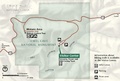
 NPS jewel-cave-map.jpg 2,112 × 1,729; 651 KB
-
 NPS jewel-cave-map.pdf 1,583 × 1,295; 935 KB
-
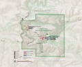
 NPS jewel-cave-national-monument-map.jpg 1,298 × 881; 175 KB
-
 NPS jewel-cave-national-monument-map.pdf 779 × 527; 1.39 MB
-
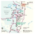
 NPS jewel-cave-regional-map.jpg 979 × 956; 157 KB
-
 NPS jewel-cave-regional-map.pdf 587 × 572; 148 KB
-
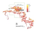
 NPS jewel-cave-vegetation-map.gif 1,692 × 1,422; 131 KB


