Category:Colorado River Basin
Jump to navigation
Jump to search
English: The Colorado River Basin (watershed).
drainage basin of the Colorado River in the western United States and Mexico | |||||
| Upload media | |||||
| Instance of | |||||
|---|---|---|---|---|---|
| Named after | |||||
| Location |
| ||||
| Located in or next to body of water | |||||
| Has part(s) |
| ||||
| Drainage basin | |||||
| Different from | |||||
| |||||
Subcategories
This category has the following 6 subcategories, out of 6 total.
Media in category "Colorado River Basin"
The following 31 files are in this category, out of 31 total.
-
Colorado watershed.png 1,000 × 1,004; 326 KB
-
Hover Dam.png 1,000 × 1,004; 356 KB
-
2001 annual report on Colorado River Basin Salinity Control Program (IA 2001annualreport00colo).pdf 631 × 825, 34 pages; 1.58 MB
-
Arizona Relief NED.jpg 422 × 500; 80 KB
-
California state Colorado River hydrologic region map 2013.jpg 1,256 × 1,766; 616 KB
-
Colorado River Basin (51277700664).jpg 3,263 × 2,014; 1.25 MB
-
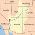
Colorado River Compact states map.svg 959 × 593; 32 KB
-
Colorado River Storage Project map.png 1,585 × 1,981; 1.51 MB
-
Colorado Watershed Map.jpg 2,500 × 2,930; 446 KB
-
Coloradorivermap (Utah detail).jpg 799 × 652; 402 KB
-
Coloradorivermapnew1.jpg 871 × 1,130; 701 KB
-
Dirtydevilriver.png 2,600 × 2,266; 7.82 MB
-
Drought-before-after.jpg 850 × 483; 95 KB
-
Escalanteriver.png 2,600 × 2,266; 6.08 MB
-
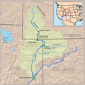
Greenutrivermap.png 500 × 500; 409 KB
-
Hover Dam 2.png 1,000 × 1,004; 369 KB
-
NRCSUT03050 - Utah (6469)(NRCS Photo Gallery).jpg 1,500 × 2,100; 5.15 MB
-
NRCSUT03050 - Utah (6469)(NRCS Photo Gallery).tif 1,500 × 2,100; 12.02 MB
-
NRCSUT03051 - Utah (6471)(NRCS Photo Gallery).jpg 1,500 × 2,100; 4.54 MB
-
NRCSUT03051 - Utah (6471)(NRCS Photo Gallery).tif 1,500 × 2,100; 12.02 MB
-
NRCSUT03052 - Utah (6473)(NRCS Photo Gallery).jpg 2,100 × 1,500; 5.58 MB
-
NRCSUT03052 - Utah (6473)(NRCS Photo Gallery).tif 2,100 × 1,500; 12.02 MB
-
NRCSUT03053 - Utah (6475)(NRCS Photo Gallery).jpg 2,100 × 1,500; 5.71 MB
-
NRCSUT03053 - Utah (6475)(NRCS Photo Gallery).tif 2,100 × 1,500; 12.02 MB
-
Rio Colorado of the West - DPLA - 70ecffad9d3a124767dc713173ed003b.jpg 1,917 × 875; 232 KB
-
Rio Colorado of the West, map no. 1 - DPLA - faa11def3915d0da9d195dec167d014a.jpg 9,000 × 4,414; 3.5 MB
-
San Joan Meander.jpg 4,624 × 3,468; 8.01 MB
-
SoCal Watershed.jpg 1,070 × 798; 525 KB
-
Usgs graphic colorado basin.jpg 650 × 893; 97 KB


