Category:Maps of Lake Huron
Jump to navigation
Jump to search
Wikimedia category | |||||
| Upload media | |||||
| Instance of | |||||
|---|---|---|---|---|---|
| Category combines topics | |||||
| Lake Huron | |||||
one of the Great Lakes of North America | |||||
| Instance of | |||||
| Part of | |||||
| Location | |||||
| Width |
| ||||
| Length |
| ||||
| Area |
| ||||
| Elevation above sea level |
| ||||
| Inflows |
| ||||
| Outflows | |||||
| Drainage basin | |||||
| Different from | |||||
 | |||||
Subcategories
This category has only the following subcategory.
Media in category "Maps of Lake Huron"
The following 48 files are in this category, out of 48 total.
-
1717 Map of St Ignace.jpg 696 × 457; 147 KB
-
1908 Lake Warren (NY Annual Report).jpg 2,420 × 1,200; 236 KB
-
A lake tour to picturesque Mackinac via the D. and C (1890) (14760949291).jpg 2,848 × 1,214; 971 KB
-
Admiralty Chart No 327 Lake Huron Sheet 1, Published 1848.jpg 6,029 × 8,156; 3.44 MB
-
Annual report of the Fruit Growers' Association of Ontario, 1910 (1911) (19176696728).jpg 2,016 × 3,564; 1.18 MB
-
Chippewa and Stanley Low Levels (Larsen 1987).jpg 1,287 × 961; 125 KB
-
Communities of the Greater Toronto Area 2.png 514 × 435; 8 KB
-
Darlinton map of lake huron 1680.png 683 × 540; 1,012 KB
-
Early map of Lake Ontario.jpg 610 × 432; 138 KB
-
FMIB 42195 Lake Huron Whitefish area (shown in black), 10 to 35 fathoms.jpeg 1,077 × 1,029; 151 KB
-
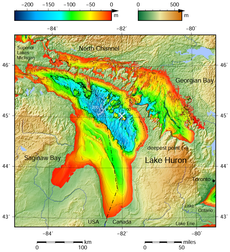
Great Lakes bathymetry map 2.png 1,024 × 731; 943 KB
-
Great Lakes bathymetry map.png 1,024 × 731; 1.34 MB
-
Great Lakes Lake Huron Georgian Bay.png 581 × 406; 9 KB
-
Great Lakes Lake Huron North Channel.png 581 × 406; 8 KB
-
Great Lakes Lake Huron.png 581 × 406; 10 KB
-
Great Lakes Lake Michigan-Huron.png 581 × 406; 7 KB
-
Great Lakes Lake Superior.png 581 × 406; 10 KB
-
Griffith Island, Georgian Bay.png 847 × 602; 70 KB
-
Huron outline.png 58 × 80; 1 KB
-
Huronie.JPG 900 × 674; 132 KB
-
HuronTract.JPG 689 × 588; 58 KB
-
Ice on the Great Lakes, Image of the Day DVIDS754779.jpg 2,400 × 3,200; 3.22 MB
-
Lac-Taronto.jpg 600 × 397; 87 KB
-
Lake Huron (Michigan highlighted).png 1,000 × 1,125; 384 KB
-
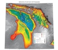
Lake Huron bathymetry map 2.png 936 × 1,024; 878 KB
-
Lake Huron bathymetry map.png 936 × 1,024; 1.35 MB
-
Lake Huron bathymetry.pdf 6,300 × 5,400; 16.87 MB
-
Lake Huron Watershed.png 355 × 435; 75 KB
-
Lake Huron.svg 300 × 300; 8 KB
-
Lake Michigan-Huron Watershed.png 435 × 355; 78 KB
-
Lake Whittlesey 1908 Fig 8 Lake Saginaw 2.jpg 1,480 × 848; 129 KB
-
Lake-Huron-red.png 786 × 533; 55 KB
-
Lake-Huron.svg 786 × 533; 74 KB
-
Lake-Michigan-Huron.svg 786 × 533; 74 KB
-
Lake-Superior-red.png 786 × 533; 54 KB
-
Les Cheneaux Islands.PNG 553 × 382; 16 KB
-
Mackinac Island topo.png 718 × 358; 494 KB
-
Manitoulin Island in Lake Huron.png 581 × 406; 16 KB
-
ManitoulinIsland2022OSM.png 6,666 × 3,714; 8.66 MB
-
Map of Huron Country, 1631–51 WDL9557.png 1,236 × 1,024; 2.02 MB
-
Map of Ontario MANITOULIN.svg 340 × 330; 84 KB
-
Ontmanid.png 378 × 379; 11 KB
-
Straits of Mackinac map.png 500 × 350; 97 KB
-
Thunder Bay NMS map.jpg 1,549 × 2,000; 442 KB
-
Walpole island ontario.png 514 × 611; 9 KB
