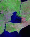
Category:St. Clair River
Appearance
river in North America on the boundary of Michigan and Ontario | |||||
| Upload media | |||||
| Instance of | |||||
|---|---|---|---|---|---|
| Location | |||||
| Length |
| ||||
| Origin of the watercourse | |||||
| Mouth of the watercourse | |||||
| Drainage basin |
| ||||
| Tributary |
| ||||
| Lake on watercourse | |||||
 | |||||
Subcategories
This category has the following 11 subcategories, out of 11 total.
Media in category "St. Clair River"
The following 74 files are in this category, out of 74 total.
-
Aerial view of the St. Clair River and Lake St. Clair.jpg 2,680 × 2,905; 1.67 MB
-
Algonac MI.JPG 2,592 × 1,296; 1.34 MB
-
Algonac State Park 2.jpg 5,179 × 2,913; 2.75 MB
-
Algonac, MI boardwalk.jpg 5,180 × 3,453; 3.08 MB
-
Canada Michigan St Clair River estuary Harsens Island IMG 1822.JPG 4,623 × 3,132; 8.15 MB
-
Canada Michigan St Clair River estuary IMG 1819.JPG 5,184 × 3,456; 11.19 MB
-
Canada Michigan St Clair River estuary IMG 1820.JPG 5,184 × 3,139; 9.12 MB
-
Canada Michigan St Clair River estuary IMG 1821.JPG 3,456 × 2,919; 5.44 MB
-
Canada Michigan St Clair River estuary IMG 1824.JPG 4,720 × 3,007; 7.17 MB
-
Canada Michigan St Clair River from Sarnia Huron IMG 1823.JPG 3,456 × 4,979; 9.52 MB
-
Canada Michigan St Claire river Lambton GS and Oil Springs IMG 1829.JPG 4,533 × 3,456; 9.21 MB
-
Canada Michigan St Claire river Ontario Lambton county Chatham-Kent county IMG 1826.JPG 3,456 × 4,681; 10.19 MB
-
Charles S Price before 1913 Great Lakes storm.png 800 × 334; 189 KB
-
Coast Guard Cutter Neah Bay breaks ice in St. Clair River 140226-G-ZZ999-001.jpg 1,280 × 854; 394 KB
-
Detroit1796.jpg 4,344 × 2,958; 1,008 KB
-
Earth observations taken during STS-74 mission DVIDS694056.jpg 5,000 × 5,000; 4.79 MB
-
Earth observations taken during STS-74 mission DVIDS711899.jpg 4,134 × 4,134; 4.15 MB
-
EPA map of the St Clair River - final state approved.pdf 2,550 × 1,650; 253 KB
-
German cargo ship Emstein after a serious collision on the St. Clair River - Canada.jpg 3,599 × 2,399; 2.97 MB
-
ISS035-E-25870 - View of Earth.jpg 4,256 × 2,832; 1.03 MB
-
Iss069e060965.jpg 5,568 × 3,712; 2.57 MB
-
Joseph Kupke Estate Harsens Island photo by Harry Garland (1954).jpg 3,084 × 3,340; 3.29 MB
-
Lake st clair landsat.jpeg 684 × 851; 174 KB
-
Lighthouse on the St. Clair River (4845453936).jpg 4,218 × 2,748; 14.39 MB
-
Marine City MI.JPG 2,592 × 1,296; 1.63 MB
-
Marysville.jpg 4,320 × 3,240; 2.98 MB
-
Michigan Macomb county Anchor Bay Selfridge AFB IMG 1812.JPG 5,184 × 3,301; 10.13 MB
-
Michigan Macomb county Anchor Bay Selfridge AFB IMG 1814.JPG 5,184 × 3,089; 8.92 MB
-
Michigan Macomb county Lake St Clair Anchor Bay Selfridge AFB IMG 1817.JPG 4,530 × 2,672; 7.62 MB
-
Michigan Macomb county Lake St Clair Anchor Bay Selfridge AFB IMG 1818.JPG 5,046 × 2,959; 9.71 MB
-
Navigation on St Clair River.jpg 1,500 × 1,051; 641 KB
-
The Venice of America, Ste. Claire Flats, Mich (NYPL b12647398-75813).tiff 2,384 × 1,590; 10.85 MB
-
Playing ice hockey on the St. Clair River (I0003277).jpg 3,900 × 2,731; 3.31 MB
-
Port Huron and Sarnia from United 643 (6304785099).jpg 1,600 × 1,200; 221 KB
-
Post Office And Customs, Sarnia, Ontario, Canada.jpg 942 × 600; 83 KB
-
Roberts Landing, Michigan road signage.jpg 4,581 × 2,576; 2.05 MB
-
Rushmere Club (NBY 10291).jpg 823 × 522; 63 KB
-
Russell Island (Michigan).jpg 5,179 × 2,913; 2.13 MB
-
Sailing on St Clair River.jpg 2,383 × 1,584; 306 KB
-
Sarnia Streetcar, 1880 -a.jpg 2,500 × 1,710; 1.84 MB
-
Sarnia, Ontario (34727256).jpg 800 × 600; 66 KB
-
St Clair MI.JPG 2,592 × 1,296; 1.61 MB
-
St. Clair River - Harsens Island - Muscamoot Bay (24672033537).jpg 2,400 × 1,600; 1.82 MB
-
St. Clair River Aerial - Michigan Ontario (25669172848).jpg 2,400 × 1,600; 1.43 MB
-
St. Clair River at Port Huron, Mich LCCN2007662292.tif 2,366 × 715; 4.85 MB
-
St. Clair sunset (3918350744).jpg 1,900 × 1,425; 634 KB
-
Ste Claire Ship Canal, lower entrance (NBY 1888).jpg 826 × 522; 50 KB
-
Tashmoo on Lake St Claire 1922.JPG 908 × 518; 35 KB
-
The coming of spring, mouth of St Clair (HS85-10-17582) original.tif 1,907 × 1,272; 7.58 MB
-
The coming of spring, mouth of St Clair (HS85-10-17582).jpg 1,611 × 1,038; 2.2 MB
-
The Venice of America, Ste Claire Flats (NBY 4289).jpg 822 × 525; 65 KB
-
USCGC Alder heads home from buoy run 131214-G-ZZ999-001.jpg 2,592 × 1,936; 2.05 MB
-
USCGC Mackinaw assists with Operation Coal Shovel 140202-G-ZZ999-005.jpg 1,200 × 840; 494 KB
-
USCGC Mackinaw assists with Operation Coal Shovel 140202-G-ZZ999-006.jpg 1,200 × 764; 457 KB
-
USCGC Neah Bay breaks ice in the St. Clair River 150309-G-ZZ999-006.jpg 4,288 × 2,848; 2.69 MB
-
USCGC Neah Bay breaks ice in the St. Clair River 150309-G-ZZ999-051.jpg 2,848 × 4,288; 2.61 MB
-
Walpole-Algonac Ferry vessels.jpg 4,557 × 2,563; 1.77 MB


