Category:Maps of Joniškis District Municipality
Jump to navigation
Jump to search
Subcategories
This category has the following 3 subcategories, out of 3 total.
J
- Joniškis in maps (3 F)
Ž
- Žagarė in maps (3 F)
Media in category "Maps of Joniškis District Municipality"
The following 8 files are in this category, out of 8 total.
-
 Joniskio rajono zemelapis.png 1,052 × 689; 161 KB
-
 JoniskioRajonoSeniunija.png 741 × 548; 279 KB
-
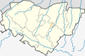
 Joniskis district location.png 623 × 503; 19 KB
-
 Joniskis district location.svg 1,095 × 821; 115 KB
-
 Joniskis dst.svg 1,000 × 800; 717 KB
-
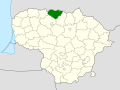
 Joniskis in Lithuania.svg 1,095 × 821; 523 KB
-
 Joniškio rajono savivaldybė.svg 1,008 × 656; 71 KB
-
 Starostva Jonishkskogo rajona.jpg 1,052 × 683; 86 KB


