Category:Maps of Italy in the 1st century
Appearance
English: This category is about the subject of  Italy 1-100 CE: History maps showing all or a substantial part of the territory of Italy as it was in the 1st century.
Contemporary old maps belong into: Category:Old maps of Italy and its subcategories.
Contemporary old maps belong into: Category:Old maps of Italy and its subcategories.
Maps of the history of Italy by century: 1st century · 2nd century · 3rd century · 4th century · 5th century · 6th century · 7th century · 8th century · 9th century · 10th century · 11th century · 12th century · 13th century · 14th century · 15th century · 16th century · 17th century · 18th century · 19th century · 20th century · 21st century ·
Media in category "Maps of Italy in the 1st century"
The following 7 files are in this category, out of 7 total.
-
C. 7 BCE Italian Peninsula.jpg 1,259 × 1,177; 1.59 MB
-
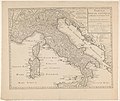
Italiae divisio - per Augustum in. XI. regiones - btv1b53177635t (1 of 2).jpg 2,320 × 1,810; 754 KB
-
Karta över Italien till kejsar Augustus tid, Nordisk familjebok.jpg 2,480 × 3,480; 1.53 MB
-
Map Italy at the time of Augustus- Touring Club Italiano CART-TRC-44.jpg 6,034 × 6,689; 4.97 MB
-
Shepherd Map of Ancient Italy, Northern Part.jpg 1,820 × 1,480; 1.21 MB
-
Shepherd-c-030-031.jpg 1,989 × 1,528; 629 KB


