Category:Maps of Greifswald
Jump to navigation
Jump to search
Wikimedia category | |||||
| Upload media | |||||
| Instance of | |||||
|---|---|---|---|---|---|
| Category combines topics | |||||
| Greifswald | |||||
town in Mecklenburg-Vorpommern, Germany     | |||||
| Instance of |
| ||||
| Location | |||||
| Located in or next to body of water | |||||
| Head of government |
| ||||
| Inception |
| ||||
| Population |
| ||||
| Area |
| ||||
| Elevation above sea level |
| ||||
| Different from | |||||
| official website | |||||
 | |||||
Media in category "Maps of Greifswald"
The following 20 files are in this category, out of 20 total.
-
 Bevölkerungsveränderung Greifswald 1992-2002.png 3,867 × 2,547; 1.22 MB
-
 Bevölkerungsveränderung Greifswald 2002-2011.png 3,867 × 2,547; 1.22 MB
-
 Darß, Rügen, Greifswald750T.png 1,328 × 957; 88 KB
-
 Dänische Wiek und Greifswald.png 1,123 × 617; 275 KB
-
 Greifswald Einwohnerdichte 2011.png 3,867 × 2,547; 1.2 MB
-
 Greifswald in German Democratic Republic.svg 618 × 789; 3 MB
-
 Greifswald in VG.svg 900 × 928; 433 KB
-
 Greifswald OSM street map.png 675 × 707; 187 KB
-
 Greifswald.png 1,969 × 1,501; 1.26 MB
-
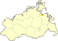 HGW in Mecklenburg-Vorpommern.svg 859 × 607; 84 KB
-
 Karte Greifswalder Bahnen.png 256 × 211; 119 KB
-
 Lage der kreisfreien Stadt Greifswald in Deutschland.png 176 × 234; 3 KB
-
 Locator map HGW in Mecklenburg-Vorpommern.svg 1,129 × 775; 260 KB
-
 Major russian gas pipelines to europe hu.png 1,200 × 1,256; 713 KB
-
 Major russian gas pipelines to europe.png 771 × 807; 211 KB
-
 Mecklenburg-Vorpommern HGW.svg 1,129 × 775; 472 KB
-
 Meyer‘s Zeitungsatlas 031 – Provinz Pommern.jpg 7,344 × 6,224; 17.16 MB
-
 Rostock, Rügen, Greifswald(MV750T).png 1,571 × 974; 104 KB
-
 Screenshot Klarschiff HGW (alte UI).png 1,920 × 1,032; 1.17 MB
-
 Stadtteile greifswalds.png 1,200 × 740; 271 KB


.png)
.png)
