Category:Maps of German Samoa
Jump to navigation
Jump to search
Media in category "Maps of German Samoa"
The following 14 files are in this category, out of 14 total.
-
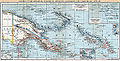
 113 kaiser-wilhelms-land-bismarck-archipel-und-samoa-inseln (1905).png 1,761 × 1,094; 1.23 MB
-
 Wirtschafts-Atlas der deutschen Kolonien - 24.jpg 2,521 × 3,352; 754 KB
-
 German Map of Samoa, 1914 (39749569941).jpg 8,505 × 3,726; 7.02 MB
-
 Kaiser-Wilhelms-Land (crop from Brockhaus).jpg 2,852 × 2,016; 2.97 MB
-
 Kaiser-Wilhelms-Land-Brockhaus b10 nr0030a hfid 5181872.jpg 5,480 × 2,805; 5.75 MB
-
 Karte der Ansiedelungen am Hafen von Apia, Insel Upolu.png 7,027 × 7,261; 63.19 MB
-
 Map of Black Saturday, 28 December 1929, Samoa (28032474070).jpg 2,500 × 1,768; 3.65 MB
-
 Map of Germany's western Pacific colonies as of 1910 (map0005325727).jpg 3,000 × 2,073; 5.97 MB
-
 Map-Kaiser-Wilhelms-Land-und-Bismarck-Archipel.png 2,314 × 1,456; 2.14 MB
-
 Pacific-German-Colonie-mk.svg 789 × 516; 791 KB
-
 Pacific-German-Colonie-ru.svg 789 × 516; 791 KB
-
 Pacific-German-Colonies-es.svg 3,057 × 2,000; 249 KB
-
 Pacific-German-Colonies.svg 789 × 516; 66 KB
-
 Deutscher Kolonialatlas mit Jahrbuch 1910 (133566329).jpg 7,155 × 7,217; 53.96 MB
.png)

.jpg)
.jpg)


.jpg)
.jpg)


.jpg)