Category:Maps of Gera
Jump to navigation
Jump to search
Districts of Thuringia:
Wikimedia category | |||||
| Upload media | |||||
| Instance of | |||||
|---|---|---|---|---|---|
| Category combines topics | |||||
| Gera | |||||
town in Thuringia, Germany | |||||
| Pronunciation audio | |||||
| Instance of |
| ||||
| Part of |
| ||||
| Location |
| ||||
| Located in or next to body of water | |||||
| Head of government |
| ||||
| Inception |
| ||||
| Population |
| ||||
| Area |
| ||||
| Elevation above sea level |
| ||||
| Different from | |||||
| official website | |||||
 | |||||
Subcategories
This category has only the following subcategory.
P
Media in category "Maps of Gera"
The following 21 files are in this category, out of 21 total.
-
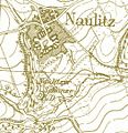
NaulitzerSchanze.jpg 523 × 539; 299 KB
-
Botanischer Garten Gera, Ŭbersicht.jpg 3,072 × 2,304; 1.63 MB
-
1850 Gera Cuba.jpg 464 × 358; 204 KB
-
Gera - Statistische Gliederung 2013.png 2,980 × 4,213; 2.58 MB
-
Gera - Statistische Gliederung.png 968 × 1,700; 226 KB
-
Gera in German Democratic Republic.svg 618 × 789; 3 MB
-
Gera Süd-Abzweig Wolfsgefärth.png 926 × 1,156; 2.25 MB
-
Gera-Position.png 188 × 235; 5 KB
-
GeraPlan.png 759 × 527; 113 KB
-
GeraPlan.PNG 742 × 524; 94 KB
-
Hofwiesenpark Gera Überblick.JPG 2,304 × 3,072; 2.78 MB
-
Lage der kreisfreien Stadt Gera in Deutschland.png 176 × 234; 4 KB
-
Location map G in Thuringia.svg 966 × 758; 622 KB
-
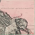
Meilenblatt B 75 Liebschwitz.jpg 9,000 × 9,040; 17.98 MB
-
Meilenblatt B 76 Grobsdorf.jpg 9,000 × 9,020; 12.53 MB
-
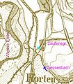
Mündung Zaufensgraben.jpg 408 × 468; 198 KB
-
Neuester Plan der Stadt - Gerabearbeitet von Reinh. Oschmann... - btv1b8443439b.jpg 11,184 × 8,494; 12.14 MB
-
Reußisches Waldtheater Karte.jpg 817 × 905; 357 KB
-
Schloss- und Parkanlage Tinz.png 4,163 × 2,888; 434 KB
-
Thuringia districts G.svg 512 × 423; 30 KB
-
Thuringia G.svg 966 × 758; 153 KB


