Category:Maps of France during World War II
Jump to navigation
Jump to search
Subcategories
This category has the following 6 subcategories, out of 6 total.
Media in category "Maps of France during World War II"
The following 30 files are in this category, out of 30 total.
-
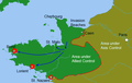
 Advance S France.jpg 269 × 700; 97 KB
-

-
 Approachtobrest.png 939 × 598; 53 KB
-
 Carte division das reich mai juin 1944.png 923 × 1,337; 31 KB
-
 Colmar Pocket Map.jpg 477 × 600; 89 KB
-
 COMZ boundaries November 1944 - January 1945.jpg 1,000 × 1,303; 371 KB
-
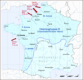
 Deutschland Besatzungszonen 1945 1946 franzoesisch.png 500 × 646; 18 KB
-
 Disposition of Foreign Troops in Southern France - NARA - 100384757 (page 1).jpg 5,888 × 4,468; 2.23 MB
-
 Disposition of Foreign Troops in Southern France - NARA - 100384757 (page 2).jpg 5,896 × 4,445; 2.25 MB
-
 Etat SS Bourguignon.png 2,215 × 2,048; 532 KB
-
 France map Lambert-93 with regions and departments-occupation (hy).png 1,326 × 1,216; 571 KB
-
 French territories under German occupation on world war 2.jpg 3,150 × 2,919; 862 KB
-
 GambsheimSonnenwende.png 1,138 × 1,498; 3.35 MB
-
 German counter in Alsace Lorraine.jpg 1,265 × 965; 2.1 MB
-
 German counter in northern Alsace Lorraine.jpg 377 × 306; 81 KB
-
 Groupe de combat Das Reich - Zone de Limoges 7-9 juin 1944.jpg 1,024 × 777; 373 KB
-
 Karte - Frankreich 1942.png 1,556 × 1,506; 585 KB
-
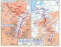
 Map of allied breakout and advance to the German border.jpg 1,024 × 748; 213 KB
-
 Map of allied breakout and advance to the Seine.jpg 1,030 × 724; 180 KB
-
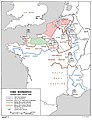
 Military administration Belgium Northern France.png 1,000 × 448; 142 KB
-
 Anvildragoon.png 690 × 556; 22 KB
-
 Plan du combat du maquis de Saint-Lys.jpg 708 × 713; 121 KB
-
 Railways in use in mid-September 1944.jpg 900 × 504; 42 KB
-
 Seventh Army Front - 1 Sep 1944.jpg 675 × 1,284; 122 KB
-
 Situation Map 2 August 1944 Evreux - Paris - NARA - 100384793.jpg 8,704 × 6,633; 4.38 MB
-
 Southern France POL pipeline.jpg 485 × 1,185; 111 KB
-
 Southern France supply lines.jpg 419 × 997; 100 KB
-
 Third Army Positions - 1 Sep 1944.png 1,830 × 1,451; 178 KB
-
 USA-E-Riviera-34.jpg 1,200 × 1,010; 416 KB
-
 WWII - The War of Lines (RU).svg 756 × 800; 2.82 MB


.jpg)
.jpg)

.png)


.svg)