Category:Maps of Serbia during World War II
Jump to navigation
Jump to search
Subcategories
This category has the following 4 subcategories, out of 4 total.
Media in category "Maps of Serbia during World War II"
The following 144 files are in this category, out of 144 total.
-
 AtlBalk1942.jpg 318 × 327; 141 KB
-
 Fascist occupation of yugoslavia-sr.png 1,076 × 1,188; 164 KB
-
 Fascist occupation of yugoslavia.png 1,076 × 1,239; 172 KB
-
 Occupation de la Yougoslavie par l'Axe, 1941-43-es.svg 1,504 × 1,509; 681 KB
-
 Occupation de la Yougoslavie par l'Axe, 1941-43.svg 1,494 × 2,051; 193 KB
-
 Axis occupation of Yugoslavia, 1941-43.png 1,076 × 1,190; 170 KB
-
 Axis occupation of Yugoslavia 1941-43 Hebrew.png 542 × 599; 136 KB
-
 Axis occupation of Yugoslavia, 1943-44-es.svg 1,504 × 1,509; 699 KB
-
 Axis occupation of Yugoslavia, 1943-44.png 1,076 × 1,190; 172 KB
-
 Occupation de la Yougoslavie par l'Axe, 1943-44.png 1,076 × 1,190; 167 KB
-
 Axis occupation of Yugoslavia 1941-43 hu.svg 1,047 × 894; 87 KB
-
 Axis occupation of Yugoslavia 1941-43 legend.png 1,047 × 1,152; 179 KB
-
 Axis occupation of Yugoslavia 1941-43.png 1,047 × 894; 50 KB
-
 Axis occupation of Yugoslavia 1943-44.png 1,047 × 894; 90 KB
-
 Fascist concentration camps in yugoslavia.png 1,076 × 1,326; 197 KB
-
 Fascist concentration camps in yugoslavia-sr.png 1,076 × 1,275; 190 KB
-
 Fascist genocide in yugoslavia.png 1,076 × 1,260; 183 KB
-
 Fascist genocide in yugoslavia-sr.png 1,076 × 1,209; 176 KB
-
 Užice and Bihać Republics.png 1,076 × 1,007; 135 KB
-
 Jvuo1942 en.png 1,076 × 1,007; 132 KB
-
 Jvuo1942 sr.png 1,076 × 1,007; 126 KB
-
 Jvuo commanders 1943 en.png 1,076 × 1,007; 132 KB
-
 Jvuo commanders 1943 sr.png 1,076 × 1,007; 126 KB
-
 Zone odgovornosti četnika, prema sporazumu sa Nemcima.png 800 × 652; 196 KB
-
 Yugoslavia moljevic1941 en.png 1,076 × 1,000; 115 KB
-
 Yugoslavia moljevic1941 sr.png 1,076 × 1,007; 131 KB
-
 Serbia moljevic1941 en.png 1,076 × 1,007; 130 KB
-
 Serbia moljevic1941 sr.png 1,076 × 1,007; 124 KB
-
 Svesrbija en.png 1,076 × 1,007; 131 KB
-
 Svesrbija sr.png 1,076 × 1,007; 125 KB
-
 1941-1943 Axis occupation of Yugoslavia map - en.svg 1,613 × 1,471; 2.89 MB
-
 1941-1943 Axis occupation of Yugoslavia map - es.svg 1,613 × 1,471; 690 KB
-
 1941-1943 Axis occupation of Yugoslavia map - hr.svg 1,613 × 1,471; 2.89 MB
-
 1941-1943 Axis occupation of Yugoslavia map - ru.svg 1,613 × 1,471; 2.89 MB
-
 1941-1943 Axis occupation of Yugoslavia map - sr.svg 1,613 × 1,471; 2.89 MB
-
 1941-1943 Axis occupation of Yugoslavia map-hu.svg 1,613 × 1,471; 415 KB
-
 1941-1943 Axis occupation of Yugoslavia map.svg 1,613 × 1,471; 2.42 MB
-
 1942 JVuO control map - en.svg 1,613 × 1,471; 984 KB
-
 1942 JVuO control map - es.svg 1,613 × 1,471; 482 KB
-
 Balcans 1942.png 651 × 698; 86 KB
-
 Beogradska operacija.jpg 2,500 × 2,316; 1.72 MB
-
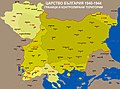
 Bulgaria 1944 WWII svg.png 266 × 329; 49 KB
-
 Bulgarian lends in WWII.jpg 3,021 × 2,232; 2.23 MB
-
 Croatia-41-45 hu.png 1,200 × 912; 327 KB
-
 Danube banovina1941 (sr).png 862 × 1,100; 103 KB
-
 Danube banovina1941.png 862 × 1,100; 108 KB
-
 Europe WWII 1942 locator map - Serbia.PNG 250 × 115; 6 KB
-
 Fascist occupation of yugoslavia hu.png 1,255 × 1,446; 604 KB
-
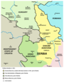
 Gebietsveränderungen Balkan 1938-43.png 387 × 617; 298 KB
-
 Harta etnica a Timocului sarbesc la nivel de plasi, 1941.jpg 1,098 × 1,412; 616 KB
-
 Hungarian Occupied Yugoslavia 1941 44.png 1,032 × 659; 249 KB
-
 Croatia 41 45 en.gif 600 × 500; 19 KB
-
 Croatia 41 45.gif 588 × 447; 23 KB
-
 Croatia-41-45.gif 588 × 447; 21 KB
-
 NDH-Croacia1941-1945.svg 2,647 × 1,995; 217 KB
-
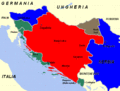
 InvasiónDeYugoslaviaAbrilDe1941.svg 1,776 × 1,471; 960 KB
-
 Kosovo 1941-sr.png 663 × 772; 48 KB
-
 Kosovo 1941.png 663 × 772; 54 KB
-
 Kretanje snaga jvuo 1945 (en).png 984 × 1,010; 91 KB
-
 Kretanje snaga jvuo 1945.png 984 × 1,010; 92 KB
-
 Localitatile din Banatul sarbesc locuite de romani, 1941.jpg 4,062 × 5,304; 3.42 MB
-
 Localitatile din Timocul sarbesc locuite de romani, 1941.jpg 4,445 × 4,327; 4.45 MB
-
 Macedonia 1944 en.png 556 × 780; 39 KB
-
 Macedonia 1944 mk.png 556 × 780; 40 KB
-
 Macedonia 1944 sr.png 556 × 780; 40 KB
-
 Madjarska okupacija Backe i Baranje, 1941-1944.png 886 × 864; 67 KB
-
 Ethnographic map of Backa and Baranja 1931.png 795 × 583; 30 KB
-
 Map of Kosovo during WW II.png 783 × 524; 97 KB
-
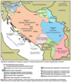
 Map of Montenegro World War Two-fr.svg 1,791 × 1,657; 70 KB
-
 MontenegroDuranteLaSegundaGuerraMundial.svg 1,919 × 1,771; 347 KB
-
 Nedićeva Srbija.jpg 1,024 × 898; 442 KB
-
 Occupation of vojvodina.png 1,548 × 1,653; 129 KB
-
 RepartoDeVoivodinaEnLaSegundaGuerraMundial.svg 1,548 × 1,653; 470 KB
-
 Ocupação da Iugoslávia pelas forças do eixo 1941-1943.svg 1,505 × 2,054; 176 KB
-
 Okupirana Jugoslavija.jpg 2,999 × 2,498; 2.3 MB
-
 Operacija Užice.jpg 3,000 × 2,658; 2.57 MB
-
 Operation25yu.jpg 1,775 × 1,544; 1.03 MB
-
 Oslobođena i poluoslobođena teritorija septembra 1941 godine u Srbiji.jpg 1,883 × 1,856; 2.02 MB
-
 Oslobođenje Srbije.jpg 1,435 × 1,080; 1.47 MB
-
 Partizanski srem01.png 1,420 × 1,245; 110 KB
-
 Partizanski srem02.png 1,420 × 1,200; 106 KB
-
 Racija1942 01.png 942 × 1,302; 99 KB
-
 Racija1942 02.png 942 × 1,263; 84 KB
-
 Republic of Uzice.png 529 × 359; 13 KB
-
 Sandzak 1943 1945 en.png 980 × 666; 63 KB
-
 Sandzak 1943 1945 sr.png 980 × 666; 61 KB
-
 Serbia 1942.svg 450 × 456; 500 KB
-
 Serbia1941 01.png 503 × 690; 32 KB
-
 Serbia1941 02.png 503 × 690; 31 KB
-
 Serbia1941 1944 01.png 503 × 690; 32 KB
-
 Serbia1941 1944 02.png 503 × 690; 31 KB
-
 Serbia1941 1944 sr.png 503 × 772; 38 KB
-
 Serbia1941 1944.png 503 × 772; 39 KB
-
 Сербия 1941-1944.jpg 503 × 724; 149 KB
-
 Serbia1941 banovine en.png 503 × 690; 47 KB
-
 Serbia1941 banovine sr.png 503 × 690; 44 KB
-
 Military Administration in Serbia.png 485 × 650; 49 KB
-
 Uzicka republika.png 503 × 690; 34 KB
-
 Uzicka republika-sr.png 503 × 690; 33 KB
-
 Uzicka republika2.png 503 × 690; 34 KB
-
 TerritoriosPartisanosOtoñoDe1941.svg 421 × 525; 101 KB
-
 Serbia 1941 44 Map cyr.png 1,320 × 1,688; 595 KB
-
 Serbia 1941 44 Map01.png 1,320 × 1,688; 594 KB
-
 Serbia 1941 44 Map - infobox version.png 1,366 × 1,726; 313 KB
-
 Serbia 1941 44 Map.png 1,366 × 1,726; 313 KB
-
 Carte GSN Serbie 1941 44.png 1,366 × 1,726; 309 KB
-
 SerbianGovernmentOfNationalSalvationCivilAdminMap - infobox version.png 500 × 632; 121 KB
-
 SerbianGovernmentOfNationalSalvationCivilAdminMap.png 500 × 607; 106 KB
-
 GebietDesMilitarbefehlshaberInSerbien-Zivilverwaltung.png 1,320 × 1,688; 602 KB
-
 TerritoryOfTheMilitaryCommanderInSerbia-CivilAdminAreas.png 1,320 × 1,688; 602 KB
-
 Military Administration in Serbia 1941-44.png 500 × 632; 92 KB
-
 Bulgarian Army deployment in occupied Serbia in World War II 2.png 500 × 632; 84 KB
-
 Bulgarian Army deployment in occupied Serbia in World War II.png 500 × 632; 70 KB
-
 TerritorioDeLaComandanciaMilitarAlemanaEnSerbia1941-1944.svg 500 × 632; 317 KB
-

-
 Territory Of The German Military Commander In Serbia 1941-44 es.png 500 × 632; 88 KB
-
 Territory Of The German Military Commander In Serbia 1941-44.png 500 × 632; 99 KB
-

-
 GebietDesMilitarbefehlshaberInSerbien-Militarverwaltung.png 1,320 × 1,688; 350 KB
-
 TerritoryOfTheMilitaryCommanderInSerbia-MilitaryAdminAreas.png 1,320 × 1,688; 349 KB
-
 VojnaUpravauSrbiji-VojnaUpravnaPodručjaCYR.png 1,320 × 1,688; 352 KB
-
 TerritoryOfTheMilitaryCommanderInSerbiaLocatorMap.png 1,320 × 1,688; 203 KB
-
 Soldatensender Belgrad.jpg 200 × 317; 35 KB
-
 Srbsko WWII es.svg 804 × 1,124; 313 KB
-
 Srbsko WWII.svg 804 × 1,124; 223 KB
-
 Uzicka republika-ru.svg 421 × 525; 20 KB
-
 Vojvodina 1944 1945 (Ru) revision 2.svg 512 × 358; 106 KB
-
 Vojvodina 1944 1945 (Ru).svg 512 × 650; 261 KB
-
 Vojvodina 1944 1945 01-es.svg 8,344 × 5,993; 460 KB
-
 Vojvodina 1944 1945 01.png 916 × 1,162; 96 KB
-
 Vojvodina 1944 1945 02.png 916 × 1,162; 102 KB
-
 Western Balkans 1942-2008-hu.svg 1,222 × 930; 248 KB
-
 Western Balkans 1942.2008 (ru).png 900 × 675; 338 KB
-
 Western Balkans 1942.2008 (ru).svg 1,200 × 900; 298 KB
-
 Western Balkans 1942.2008 ca.svg 1,222 × 930; 246 KB
-
 Western Balkans 1942.2008 ES.svg 1,222 × 930; 543 KB
-
 Western Balkans 1942.2008 sr.svg 1,200 × 900; 298 KB
-
 Western Balkans 1942.2008.png 800 × 600; 292 KB
-
 WorldWarIILocationMapBA.png 630 × 766; 23 KB
-
 WorldWarIILocationMapSE.png 630 × 766; 23 KB
-
 WWII Occupied Yugoslavia Locator Map.png 1,210 × 1,101; 255 KB
-
 Yugoslavia 1941 bs.PNG 448 × 248; 68 KB
-
 Yugoslavia 1941.png 448 × 248; 68 KB
-
 Недичева Србија - Wiki.png 6,000 × 6,830; 1.75 MB


.png)


.png)


_revision_2.svg)
.svg)


.png)
.svg)


