Category:Maps of European Russia
Jump to navigation
Jump to search
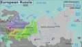
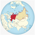
European Russia (Russian: Европейская Россия, европейская часть России) is the western and most populated part of Russia. It is geographically situated in Europe, as opposed to the country's sparsely populated and vastly larger eastern part, which is situated in Asia, encompassing the entire northern region of the continent. The Ural Mountains divides Russia into two parts, bisecting the Eurasian supercontinent. European Russia covers the vast majority of Eastern Europe, and spans roughly 40% of Europe's total landmass, with over 80% of its total population, making Russia the largest and most populous country in Europe.
Subcategories
This category has only the following subcategory.
Media in category "Maps of European Russia"
The following 33 files are in this category, out of 33 total.
-
 Central Russia map.svg 499 × 485; 6.63 MB
-
 Circondario federale meridionale - Russia.png 1,024 × 786; 190 KB
-
 Continental division of Russia by subjects.png 5,686 × 3,844; 1.65 MB
-
 Europaeisches Russland, auch Schweden u. Norwegen.jpg 5,568 × 4,562; 8.7 MB
-
 European Russia (orthographic projection).svg 600 × 600; 691 KB
-
 European Russia laea location map (Crimea disputed).svg 1,181 × 1,558; 3.29 MB
-
 European Russia laea location map (de facto).png 454 × 599; 184 KB
-
 European Russia laea location map (disputed territories).svg 4,185 × 5,520; 3.37 MB
-
 European Russia laea location map (incl Crimea).svg 1,181 × 1,558; 3.16 MB
-
 European Russia laea location map (without Crimea).svg 1,181 × 1,558; 2.8 MB
-
 European Russia laea location map 66K-16.svg 709 × 624; 3.32 MB
-
 European Russia laea location map A130.svg 709 × 624; 3.32 MB
-
 European Russia laea location map P120.svg 709 × 624; 3.32 MB
-
 European Russia.png 2,996 × 1,722; 1.41 MB
-
 Europäisches Russland.jpg 5,532 × 4,529; 7.81 MB
-
 Koppen-Geiger Map European Russia future.svg 1,429 × 850; 2.02 MB
-
 Koppen-Geiger Map European Russia present.svg 1,429 × 850; 1.94 MB
-
 Map of Russia - Black Earth.svg 1,092 × 630; 231 KB
-
 Map of the Russian Empire in Europe.jpg 2,934 × 3,461; 2.57 MB
-
 Map of the western border of Russia.png 794 × 965; 256 KB
-
 Northern Caucasus of European Russia.png 1,959 × 2,283; 235 KB
-
 PAT - European Russia.gif 1,600 × 2,000; 1.04 MB
-
 Range of Hieracium lachenalii-Russia.svg 1,650 × 1,000; 139 KB
-
 Religion of the majority in the European part of Russia.png 2,038 × 2,129; 579 KB
-
 Rusia europea.PNG 913 × 1,192; 390 KB
-
 Russia europea.png 913 × 1,192; 404 KB
-
 Russia in Europe from Court Game of Geography MET DP862889.jpg 808 × 1,201; 368 KB
-
 Subbotnik map.png 650 × 675; 326 KB
-
 Subdivisions of European Russia.jpg 3,288 × 1,995; 152 KB
-
 USSR map Europe Caucasus.jpg 973 × 681; 153 KB
-
 Volosovo.png 737 × 510; 50 KB
-
 Western Russia.png 550 × 548; 240 KB
-
 Епархии РПЦ на 1.01.2015 (Европейская часть РФ).png 4,488 × 2,640; 1,020 KB


.svg)
.svg)
.png)
.svg)
.svg)
.svg)


.png)