
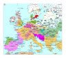
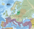
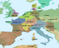
Category:Maps of Europe in the 5th century
English: This category is about the subject of Europe 401-500 CE: History maps showing all or a substantial part of the territory of Europe as it was in the 5th century.
Contemporary old maps belong into: Category:Old maps of Europe and its subcategories.
Contemporary old maps belong into: Category:Old maps of Europe and its subcategories.
Maps of the history of Europe: (BCE) 9th century · 8th century · 5th century · 4th century · 3rd century · 2nd century · 1st century · (CE) 1st century · 2nd century · 3rd century · 4th century · 5th century · 6th century · 7th century · 8th century · 9th century · 10th century · 11th century · 12th century · 13th century · 14th century · 15th century · 16th century · 17th century · 18th century · 19th century · 20th century · 21st century ·
Subcategories
This category has the following 15 subcategories, out of 15 total.
Media in category "Maps of Europe in the 5th century"
The following 130 files are in this category, out of 130 total.
-
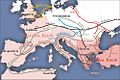
 C. 450 Roman and Hun Empires.jpg 1,700 × 1,097; 1.16 MB
-
 C. 451 Europe.jpg 1,487 × 1,123; 669 KB
-
 C. 476 Europe.jpg 1,173 × 879; 678 KB
-
 A history of Rome (1917) (14761644194).jpg 2,058 × 2,922; 1.26 MB
-
 A history of Rome (1917) (14783871183).jpg 2,020 × 2,928; 844 KB
-
 C. 486 Germanic Kingdoms.jpg 769 × 921; 1.1 MB
-
 C. 500 Europe.jpg 1,498 × 1,125; 718 KB
-
 2022 10 16 - Westgermanisch – um 476 - END.png 2,752 × 2,811; 3.75 MB
-
 2022 11 13 - Map West Germanic – cc. 476 CE - final.png 2,752 × 2,811; 3.73 MB
-
 Europe en 400.pdf 1,752 × 1,239; 444 KB
-
 Europa BV042512114.jpg 1,171 × 1,197; 204 KB
-
 406 CE, Europe.svg 512 × 438; 1.76 MB
-
 420 CE, Europe.svg 512 × 438; 1.76 MB
-
 Europe en 450.pdf 1,752 × 1,239; 457 KB
-
 450 roman-hunnic-empire-ca.svg 1,758 × 1,118; 2.39 MB
-
 450 roman-hunnic-empire-es.svg 1,648 × 1,049; 2.25 MB
-
 450 roman-hunnic-empire-fr.svg 1,648 × 1,049; 1.69 MB
-
 450 roman-hunnic-empire-pt.svg 1,648 × 1,049; 3.11 MB
-
 451 CE, Europe.svg 512 × 438; 1.5 MB
-
 Map of Europe, 459 CE.png 2,602 × 1,393; 540 KB
-
 Atlas of European history (1909) (14597297739).jpg 2,170 × 1,600; 832 KB
-
 476 CE, Europe.svg 512 × 438; 1.48 MB
-
 476eur.jpg 620 × 411; 221 KB
-
 38 of '(Italy and her Invaders, Vol. 1-4.)' (11217687916).jpg 2,995 × 2,485; 1.53 MB
-
 500 fall-roman-empire-ca.svg 1,758 × 1,118; 1.91 MB
-
 500 fall-roman-empire-fr.svg 1,648 × 1,049; 1.83 MB
-
 558 of '(Italy and her Invaders, Vol. 1-4.)' (11218598665).jpg 2,336 × 1,469; 1,019 KB
-

-
 Ahdofour1.jpg 2,977 × 2,273; 4.26 MB
-
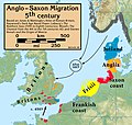 Anglo.Saxon.migration.5th.cen.jpg 1,800 × 1,703; 875 KB
-
 Central Europe 5th century blank.jpg 1,147 × 763; 557 KB
-
 Central Europe 5th Century.jpg 1,088 × 763; 457 KB
-
 Central Europe 5th Century.resize-ratio-1-1.jpg 763 × 763; 291 KB
-
 Central Europe End 5th Century Blank X.jpg 1,088 × 763; 482 KB
-
 Central Europe End 5th Century German.jpg 1,088 × 763; 519 KB
-
 Christian states 495 AD (en).png 2,436 × 1,372; 358 KB
-
 Christian states 495 AD (en).svg 2,436 × 1,372; 3.61 MB
-
 Christian states 495 AD (pl).svg 946 × 631; 122 KB
-
 Christian states 495 AD (ru).svg 946 × 631; 123 KB
-
 Christian states 495 AD (tr).svg 946 × 631; 122 KB
-
 Christian states 495 AD-hu.svg 946 × 631; 132 KB
-
 Crossing of the Rhine map.jpg 5,476 × 3,310; 7.07 MB
-
 Detailed Domain of Soissons.svg 1,052 × 744; 663 KB
-
 East europe 5-6cc.png 3,935 × 3,033; 344 KB
-
 East-Hem 476ad (cropped).jpg 1,042 × 685; 167 KB
-
 Empire of Attila.png 1,333 × 841; 644 KB
-
 Europa anno 469.png 1,500 × 897; 438 KB
-
 Europa BV042518417 (cropped).jpg 1,132 × 1,066; 192 KB
-
 Europa BV042518459.jpg 1,954 × 1,337; 308 KB
-
 Europa BV043417545.jpg 1,954 × 1,337; 311 KB
-
 Europe and the Near East at 476 AD.png 2,830 × 1,967; 1.58 MB
-
 Europe at the fall of the Western Roman Empire in 476.jpg 5,491 × 3,506; 4.35 MB
-
 Europe en 401.pdf 1,752 × 1,239; 444 KB
-
 Europe en 451.pdf 1,752 × 1,239; 456 KB
-
 Europe in the Migration Period in the 4th and 5th centuries.jpg 5,476 × 3,310; 4.33 MB
-
 Europe map 450 PL.PNG 800 × 580; 158 KB
-
 Europe map 450-ar.png 800 × 580; 158 KB
-
 Europe map 450.PNG 800 × 580; 145 KB
-
 Európa 450 körül.png 801 × 580; 143 KB
-
 Európa 454.svg 512 × 542; 11.51 MB
-
 Európa 500-es.svg 1,042 × 1,100; 4.07 MB
-
 Európa 500.svg 512 × 542; 4.91 MB
-
 Gothic Kingdoms.png 608 × 342; 59 KB
-
 Großbritannien BV042518600.jpg 1,954 × 1,337; 302 KB
-

-
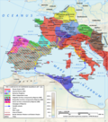
 Illyricum & Dacia - AD 400.png 971 × 673; 972 KB
-
 Impero d'Occidente 410.PNG 900 × 595; 123 KB
-
 Impero d'Occidente 421.PNG 900 × 595; 122 KB
-
 Impero d'Occidente 445.PNG 900 × 595; 124 KB
-
 Indo-Sassanid.jpg 762 × 545; 581 KB
-
 Invasionsbarbares.PNG 624 × 575; 107 KB
-
 Karta pereseleniya.jpg 1,000 × 707; 121 KB
-
 Karte völkerwanderung.jpg 1,000 × 663; 116 KB
-
 Khazars498.jpg 402 × 480; 115 KB
-
 Kingdom of the Suebi Map c.455.png 2,000 × 1,701; 159 KB
-
 Los reinos germánicos en el siglo V.png 1,016 × 774; 734 KB
-
 MajorianEmpire.png 1,220 × 1,385; 1.51 MB
-
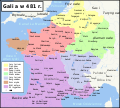
 Map Gaul divisions 481-es.svg 755 × 784; 646 KB
-
 Map Gaul divisions 481-fr.svg 755 × 784; 283 KB
-
 Map Gaul divisions 481-nl.svg 755 × 784; 144 KB
-
 Map Gaul divisions 481-pl.svg 1,968 × 1,776; 1.09 MB
-
 Map Gaul divisions 481-pt.svg 755 × 784; 116 KB
-
 Map of the Christian world around the mediterranean in the 5th century AD.png 1,117 × 653; 206 KB
-
 Maps, and tables of chronology and genealogy; (1831) (14759314116).jpg 3,216 × 2,504; 1.31 MB
-

-
 NE 475ad.jpg 1,406 × 1,028; 233 KB
-
 NE 500ad.jpg 1,424 × 1,049; 238 KB
-
 Near East480ad.jpg 1,402 × 1,023; 226 KB
-
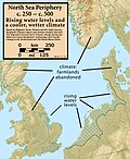 North.Sea.Periphery.250.500.jpg 2,031 × 2,463; 820 KB
-
 Odoacer 480ad.jpg 900 × 545; 701 KB
-
 Ostmitteleuropa BV042518454.jpg 1,954 × 1,337; 307 KB
-
 Public Schools Historical Atlas - Europe 476-493.jpg 1,579 × 1,239; 610 KB
-
 Putz22.jpg 2,535 × 2,001; 976 KB
-
 Regne visigot de Tolosa 490-507.svg 653 × 678; 38 KB
-
 Reino de los visigodos-Br.svg 779 × 800; 90 KB
-
 Reino de los visigodos-cs.svg 653 × 670; 35 KB
-
 Reino de los visigodos-de.svg 653 × 670; 124 KB
-
 Reino de los visigodos-en.svg 653 × 670; 38 KB
-
 Reino de los visigodos-gl.png 1,000 × 1,025; 142 KB
-
 Reino de los visigodos-it.svg 653 × 670; 35 KB
-
 Reino de los visigodos-pl.svg 653 × 670; 35 KB
-
 Reino de los visigodos-pt.svg 649 × 663; 18 KB
-
 Reino de los visigodos-sh.svg 653 × 670; 35 KB
-
 Reino de los visigodos-sr.svg 653 × 670; 35 KB
-
 Reino de los visigodos-zh.svg 653 × 670; 35 KB
-
 Reino de los visigodos.svg 653 × 678; 59 KB
-
 Roman Empire 460.png 1,131 × 808; 162 KB
-
 Rome - its rise and fall; a text-book for high schools and colleges (1900) (14598102770).jpg 2,660 × 3,860; 1.17 MB
-
 Royaume des Wisigoths.jpg 599 × 611; 348 KB
-
 Saxon.emigration.5th.cen.jpg 2,301 × 2,140; 1,000 KB
-
 South-east Sicily Citites of V century.jpg 558 × 325; 18 KB
-

-
 Vandali.jpg 1,477 × 2,032; 2.56 MB
-
 Vandals Migration 406-418.png 905 × 881; 133 KB
-
 Vandals Migration it.PNG 1,725 × 1,739; 527 KB
-
 Vandals Migration pt.gif 1,725 × 1,739; 236 KB
-
 Vandals Migration ua.PNG 1,725 × 1,739; 536 KB
-
 Vatra.jpg 2,128 × 1,515; 203 KB
-
 Visigoth Kingdom-de.png 599 × 611; 205 KB
-
 Visigoth Kingdom.jpg 599 × 611; 81 KB
-
 Visigothic Kingdom Map c.500.png 1,985 × 1,686; 230 KB
-
 Western Europe 5th Century ang.svg 700 × 575; 2.3 MB
-
 Western Europe 5th Century en.svg 700 × 575; 2.3 MB
-
 Western Europe 5th Century la.svg 700 × 575; 2.3 MB
-
 Western Europe in 481 AD According to Heinz Ritter-Schaumburg.png 730 × 630; 168 KB
-
 Western Europe in 500 AD According to Heinz Ritter-Schaumburg.png 730 × 630; 159 KB
-
 Historical atlas of modern Europe 1903 (135895337).jpg 9,181 × 6,734; 53.44 MB
-

-
 Гунны 2.jpg 696 × 435; 57 KB
-
 הממלכה הוויזיגותית.svg 653 × 670; 56 KB


_(14761644194).jpg)
_(14783871183).jpg)


_(14597297739).jpg)


%27_(11217687916).jpg)


%27_(11218598665).jpg)
.jpg)


.png)
.svg)
.svg)
.svg)
.svg)


.jpg)


.jpg)


_(14759314116).jpg)
_(14782974695).jpg)


_(14598102770).jpg)


_(14781526025).jpg)


.jpg)
.jpg)

