Category:Maps of Ely
Jump to navigation
Jump to search
Media in category "Maps of Ely"
The following 7 files are in this category, out of 7 total.
-
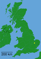 Ely - Cambridgeshire dot.png 417 × 599; 122 KB
-
 Ely.jpg 2,920 × 1,841; 348 KB
-
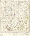 Ordnance Survey One-Inch Sheet 135 Cambridge & Ely, Published 1967.jpg 8,285 × 9,971; 9.71 MB
-
 Ordnance Survey One-Inch Sheet 135 Cambridge & Ely, Published 1969.jpg 8,281 × 9,866; 28.33 MB
-
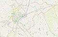
 Proposed Ely Southern Bypass.png 450 × 430; 76 KB
-
 Screen Shot of WikiShootMe V3.png 559 × 288; 82 KB
-
 Screen Shot WikiShootMe V3.png 602 × 455; 211 KB


