Category:Maps of Darmstadt
Jump to navigation
Jump to search
Districts of Hesse:
Urban districts (cities):
Wikimedia category | |||||
| Upload media | |||||
| Instance of | |||||
|---|---|---|---|---|---|
| Category combines topics | |||||
| Darmstadt | |||||
city in Hesse, Germany  _Panorama.jpg) _Panorama.jpg)   Greater coat of arms of the city of Darmstadt .svg)  | |||||
| Instance of |
| ||||
| Part of | |||||
| Location |
| ||||
| Located in or next to body of water | |||||
| Head of government |
| ||||
| Has part(s) | |||||
| Inception |
| ||||
| Population |
| ||||
| Area |
| ||||
| Elevation above sea level |
| ||||
| Different from | |||||
| official website | |||||
 | |||||
Subcategories
This category has the following 2 subcategories, out of 2 total.
P
Media in category "Maps of Darmstadt"
The following 57 files are in this category, out of 57 total.
-
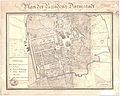
 Fr residenz1836 gross.jpg 1,553 × 1,788; 965 KB
-
 Map Darmstadt 1836.png 2,670 × 2,230; 10.24 MB
-
 Darmstadt-Hofmeierei 1850.jpg 2,548 × 1,896; 2.39 MB
-
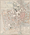
 Fr planDa1858 gross.jpg 2,801 × 2,230; 1.21 MB
-
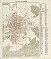
 Fr plan1901 gross.jpg 2,853 × 2,230; 1.65 MB
-
 Map Darmstadt 1905.jpg 1,600 × 1,100; 539 KB
-
 Fr plan1906 gross.jpg 2,230 × 2,368; 969 KB
-
 Map Darmstadt 1906.jpg 1,600 × 1,076; 1.24 MB
-
 Fr plan1908 gross.jpg 1,886 × 2,197; 1.5 MB
-
 6117Darmstadt1910Kopie.jpg 1,689 × 1,742; 1.45 MB
-
 Darmstadt Germany street map.svg 3,210 × 2,984; 12.38 MB
-
 Darmstadt in Germany.png 188 × 235; 5 KB
-
 Darmstadt OSM 01 ritagliata.png 563 × 720; 411 KB
-
 Darmstadt OSM 01.png 761 × 837; 400 KB
-
 Darmstadt OSM 02.png 761 × 837; 719 KB
-
 Dreieck Darmstadt Griesheim.jpg 325 × 326; 73 KB
-
 Dreieck Darmstadt.jpg 294 × 294; 49 KB
-
 EB9 Darmstadt.jpg 1,244 × 1,689; 3.66 MB
-
 EB9 Darmstadt.png 1,244 × 1,689; 2.02 MB
-
 Fr darmstadt 1799.jpg 3,263 × 2,169; 2.25 MB
-
 Fr darmstadt 1874 heberer gross.jpg 4,040 × 2,920; 3.3 MB
-
 Fr darmstadt 18xx gross.jpg 4,040 × 3,140; 2.87 MB
-
 Fr darmstadt umgebung 1802 gross comp.jpg 4,040 × 2,730; 2.76 MB
-
 Fr karte ulb 1799 gross.jpg 2,030 × 1,945; 1.39 MB
-
 Fr karte ulb 1822 gross.jpg 2,030 × 2,579; 1.48 MB
-
 Fr karte ulb 1866 gross.jpg 1,998 × 2,164; 1.54 MB
-
 Fr plan1846 gross.png 1,524 × 1,765; 2.22 MB
-
 Frame40 suedhessen 1887 gross.jpg 4,040 × 3,281; 4.43 MB
-
 Gliederung der kreisfreien Stadt Darmstadt.png 566 × 714; 47 KB
-
 HaasDarmstadt.JPG 1,415 × 1,289; 775 KB
-
 Hessen DA.png 722 × 957; 102 KB
-
 Karte Darmstadt 1888 schloesser.png 1,081 × 680; 735 KB
-
 Karte Darmstadt MKL1888.png 1,275 × 1,084; 579 KB
-
 Karte Darmstadt und Umgebung.png 927 × 814; 1.44 MB
-
 Lage Bessungens in Darmstadt.gif 453 × 604; 10 KB
-
 Lage der kreisfreien Stadt Darmstadt in Deutschland.gif 176 × 234; 3 KB
-
 Lageplan darmstadt.jpg 152 × 178; 3 KB
-
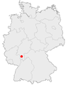
 Locator map DA (town) in Hesse.svg 868 × 1,164; 655 KB
-
 Map Darmstadt 1900.png 881 × 689; 847 KB
-
 Map Darmstadt 1935.png 4,297 × 3,557; 6.95 MB
-
 Map Darmstadt 1980.jpg 1,649 × 1,243; 462 KB
-
 Map DARMSTADT Stadtteile.svg 744 × 1,052; 87 KB
-
 Map DARMSTADT Statistische Bezirke.svg 744 × 1,052; 88 KB
-
 Map DARMSTADT.svg 744 × 1,052; 88 KB
-
 Map Großherzogliche Residenzstadt Darmstadt.png 762 × 896; 310 KB
-
 Meyers b4 s0557 b1.png 490 × 404; 143 KB
-
 Meyers b4 s0557.jpg 800 × 1,275; 478 KB
-
 Plan-Darmstadt-1759.jpg 1,314 × 879; 1.03 MB
-
 Stadtteile von Darmstadt bunt.svg 693 × 897; 76 KB
-
 Stadtteile von Darmstadt.svg 693 × 897; 76 KB
-
 Statistische Bezirke Darmstadt alle Bezirke.svg 693 × 897; 76 KB
-
 Statistische Bezirke Darmstadt Außenbezirke.svg 693 × 897; 85 KB
-
 Statistische Bezirke Darmstadt bunt.svg 693 × 897; 76 KB
-
 Statistische Bezirke Darmstadt Innenbezirke.svg 693 × 897; 85 KB
-
 Statistische Bezirke Darmstadt.svg 693 × 897; 76 KB
-
 Umweltzone Darmstadt.png 1,084 × 884; 1.34 MB
-
 Waldfriedhof03.jpg 1,536 × 1,817; 388 KB


_in_Hesse.svg)


