Category:Maps of Conwy County Borough
Jump to navigation
Jump to search
Wikimedia category | |||||
| Upload media | |||||
| Instance of | |||||
|---|---|---|---|---|---|
| Category combines topics | |||||
| Conwy County Borough | |||||
principal area in north-east Wales   | |||||
| Instance of |
| ||||
| Location | Wales | ||||
| Located in or next to body of water | |||||
| Capital | |||||
| Inception |
| ||||
| Population |
| ||||
| Area |
| ||||
| Replaces |
| ||||
| official website | |||||
 | |||||
Subcategories
This category has the following 4 subcategories, out of 4 total.
Media in category "Maps of Conwy County Borough"
The following 25 files are in this category, out of 25 total.
-
 Anglesey and Carnarvan.jpg 3,456 × 2,592; 5.36 MB
-
 1899 map of Prince Llewellyn quarry.png 1,626 × 1,158; 2.48 MB
-
 2024 Wales Conwy Constituencies map.svg 512 × 458; 14 KB
-
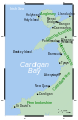
 BaeCeredigion.svg 2,030 × 3,120; 71 KB
-
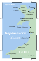
 CardiganBay cy.svg 2,030 × 3,120; 65 KB
-
 CardiganBay mk.svg 2,030 × 3,120; 252 KB
-
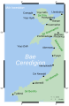
 CardiganBay.svg 2,030 × 3,120; 66 KB
-
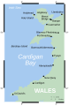
 CardiganBay2.svg 2,030 × 3,120; 69 KB
-
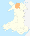
 Conwy in Wales.svg 1,047 × 1,252; 395 KB
-
 Conwy town wall plan.jpg 811 × 539; 107 KB
-
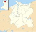
 Conwy UK community map (blank).svg 1,425 × 1,275; 846 KB
-
 Conwy UK location map.svg 1,425 × 1,275; 731 KB
-
 Conwy UK map.svg 1,425 × 1,275; 490 KB
-
 Conwy UK relief location map.jpg 1,999 × 1,789; 466 KB
-
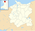
 Conwy UK ward map (blank).svg 1,425 × 1,275; 782 KB
-
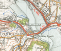 Conwymap1947.png 1,047 × 876; 1.64 MB
-
 Map of Chwarel Ddu in 1888.png 1,502 × 1,112; 2.92 MB
-
 Map of Ty'n-y-bryn and Penllyn quarries, 1911.png 2,790 × 1,218; 4.43 MB
-
 Penmaen-mawrmap 1947.png 1,371 × 1,061; 3.25 MB
-
 Wales Conwy locator map.svg 1,047 × 1,251; 147 KB
-
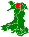 Wales Conwy.png 335 × 431; 7 KB
-
 Wales Conwy.svg 512 × 612; 277 KB
-
 WalesColwyn1974.png 400 × 490; 12 KB
-
 WalesConwy.png 200 × 225; 22 KB
-
 YOU ARE HERE - Lower Gate Street, Conwy - geograph.org.uk - 2586263.jpg 4,000 × 3,000; 6.15 MB


.svg)
.svg)