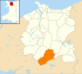
Category:Locator maps of communities in Conwy County Borough
Jump to navigation
Jump to search
Media in category "Locator maps of communities in Conwy County Borough"
The following 40 files are in this category, out of 40 total.
-
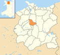
Conwy County Borough Wales communities - Bro Garmon locator.png 800 × 740; 91 KB
-
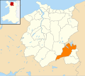
Conwy County Borough Wales communities - Bro Machno locator.png 800 × 740; 91 KB
-
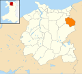
Conwy County Borough Wales communities - Conwy locator.png 800 × 740; 91 KB
-
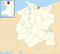
Conwy County Borough Wales communities - Kinmel Bay and Towyn.png 800 × 740; 91 KB
-
Wales Conwy Community Abergele map.svg 512 × 458; 612 KB
-
Wales Conwy Community Betws Yn Rhos map.svg 512 × 458; 612 KB
-
Wales Conwy Community Betws-y-Coed map.svg 512 × 458; 612 KB
-
Wales Conwy Community Bro Garmon map.svg 512 × 458; 612 KB
-
Wales Conwy Community Bro Machno map.svg 512 × 458; 612 KB
-
Wales Conwy Community Caerhun map.svg 512 × 458; 612 KB
-
Wales Conwy Community Capel Curig map.svg 512 × 458; 612 KB
-
Wales Conwy Community Cerrigydrudion map.svg 512 × 458; 612 KB
-
Wales Conwy Community Colwyn Bay map.svg 512 × 458; 612 KB
-
Wales Conwy Community Conwy map.svg 512 × 458; 612 KB
-
Wales Conwy Community Dolgarrog map.svg 512 × 458; 612 KB
-
Wales Conwy Community Dolwyddelan map.svg 512 × 458; 612 KB
-
Wales Conwy Community Eglwysbach map.svg 512 × 458; 612 KB
-
Wales Conwy Community Henryd map.svg 512 × 458; 612 KB
-
Wales Conwy Community Kinmel Bay and Towyn map.svg 512 × 458; 612 KB
-
Wales Conwy Community Llanddoged and Maenan map.svg 512 × 458; 612 KB
-
Wales Conwy Community Llanddulas and Rhyd-y-Foel map.svg 512 × 458; 612 KB
-
Wales Conwy Community Llandudno map.svg 512 × 458; 612 KB
-
Wales Conwy Community Llanfair Talhaiarn map.svg 512 × 458; 612 KB
-
Wales Conwy Community Llanfairfechan map.svg 512 × 458; 612 KB
-
Wales Conwy Community Llanfihangel Glyn Myfyr map.svg 512 × 458; 612 KB
-
Wales Conwy Community Llangernyw map.svg 512 × 458; 612 KB
-
Wales Conwy Community Llangwm map.svg 512 × 458; 612 KB
-
Wales Conwy Community Llannefydd map.svg 512 × 458; 612 KB
-
Wales Conwy Community Llanrwst map.svg 512 × 458; 612 KB
-
Wales Conwy Community Llansanffraid Glan Conwy map.svg 512 × 458; 612 KB
-
Wales Conwy Community Llansannan map.svg 512 × 458; 612 KB
-
Wales Conwy Community Llysfaen map.svg 512 × 458; 612 KB
-
Wales Conwy Community Mochdre map.svg 512 × 458; 612 KB
-
Wales Conwy Community Old Colwyn map.svg 512 × 458; 612 KB
-
Wales Conwy Community Penmaenmawr map.svg 512 × 458; 612 KB
-
Wales Conwy Community Pentrefoelas map.svg 512 × 458; 612 KB
-
Wales Conwy Community Rhos-on-Sea map.svg 512 × 458; 612 KB
-
Wales Conwy Community Trefriw map.svg 512 × 458; 612 KB
-
Wales Conwy Community Ysbyty Ifan map.svg 512 × 458; 612 KB


