Category:Maps of Bournemouth
Jump to navigation
Jump to search
Media in category "Maps of Bournemouth"
The following 28 files are in this category, out of 28 total.
-
-
-
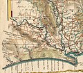 Bournemouth area 1759 map.jpg 1,673 × 1,465; 1.3 MB
-
 West Parley Historical Map Excerpt.PNG 541 × 425; 562 KB
-

-
 Admiralty Chart No 2175 Poole Bay, Published 1957.jpg 16,422 × 11,308; 62.09 MB
-
 Bournemouth in the UK.png 324 × 483; 40 KB
-
 Bournemouth unparished area UK locator map.svg 1,425 × 904; 194 KB
-
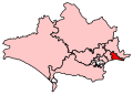 BournemouthEast2007Constituency.svg 209 × 149; 116 KB
-
 BournemouthEastConstituency.svg 200 × 140; 12 KB
-
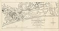
 Bournemouthmap 1937.jpg 3,504 × 2,544; 1.74 MB
-
 BournemouthWest2007Constituency.svg 209 × 149; 116 KB
-
 BournemouthWestConstituency.svg 200 × 140; 12 KB
-
 Charminster map, highlight Charminster Road and Malmesbury Park Road.png 2,064 × 1,227; 1.48 MB
-
 DorsetBournemouth.png 200 × 139; 8 KB
-
 Iford map, highlighting Iford Bridge.png 2,064 × 1,227; 1.37 MB
-
 Location of Shin's murder in relation to the road and town.png 1,410 × 1,155; 1.22 MB
-

-
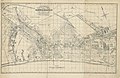
 Map of Bournemouth England.jpg 3,209 × 2,526; 7.09 MB
-

-
 Map of West Howe, highlighting Cunningham Crescent and Moorside Close.png 2,064 × 1,227; 2.21 MB
-
 Ordnance Survey One-Inch Sheet 179 Bournemouth, Published 1940.jpg 8,218 × 9,543; 10.36 MB
-
 Ordnance Survey One-Inch Sheet 179 Bournemouth, Published 1966.jpg 8,597 × 10,946; 19.46 MB
-
 Ordnance Survey One-Inch Sheet 179 Bournemouth, Published 1971.jpg 11,013 × 13,168; 43.96 MB
-
 Shin's movements from Inferno nightclub to the scene of her murder.png 1,241 × 1,155; 1.36 MB
-
 South West Hampshire & South East Dorset Green Belt.svg 2,641 × 1,690; 9.52 MB
-
 Springbourne map, highlighting St Clements Road.png 2,064 × 1,227; 2.05 MB
-
 The scene of Shin's murder in relation to Restivo's address.png 1,241 × 1,155; 801 KB
._(With_plates_and_a_map.)%27_(11170847376).jpg)
%27_(11211238134).jpg)


%27_(11212211693).jpg)


