Category:Maps of Belfast
Jump to navigation
Jump to search
Wikimedia category | |||||
| Upload media | |||||
| Instance of | |||||
|---|---|---|---|---|---|
| Category combines topics | |||||
| Belfast | |||||
city of the United Kingdom, capital of Northern Ireland | |||||
| Spoken text audio | |||||
| Pronunciation audio | |||||
| Instance of |
| ||||
| Named after | |||||
| Location |
| ||||
| Population |
| ||||
| Area |
| ||||
| Elevation above sea level |
| ||||
| Different from | |||||
| official website | |||||
 | |||||
Subcategories
This category has the following 5 subcategories, out of 5 total.
Media in category "Maps of Belfast"
The following 27 files are in this category, out of 27 total.
-
A guide to Belfast and the counties of Down and Antrim (1902) (14592665920).jpg 1,434 × 1,885; 441 KB
-
Belfast Airport in relation to Belfast City.png 914 × 599; 246 KB
-
Belfast Cliftonville-Crusaders map.png 1,035 × 678; 686 KB
-
Belfast location map.png 1,079 × 912; 993 KB
-
Belfast Metropolitan Area Map.png 7,015 × 4,960; 2.16 MB
-
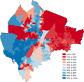
Belfast National identity 2021.png 3,507 × 2,480; 925 KB
-
Belfast Northern Ireland UK street map.svg 2,486 × 2,450; 7.29 MB
-
Belfast Protestant 2001-2021.gif 1,920 × 1,358; 288 KB
-
Belfast.gif 1,920 × 1,358; 285 KB
-
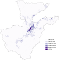
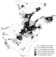
Born Outside UK And Ireland Belfast City Council 2011 Census.png 17,284 × 16,862; 8.44 MB
-
Born Outside UK And Ireland Belfast Metropolitan Area 2011 Census.png 16,565 × 16,917; 9.77 MB
-
Conflict deaths of the Troubles 1920-1922 in Belfast.jpg 1,208 × 1,136; 71 KB
-
Court DEA wards - Belfast City Council.svg 648 × 648; 2.6 MB
-
Dkbkpl37.jpg 1,165 × 702; 156 KB
-
Farset river map.jpg 451 × 450; 94 KB
-
GreaterBelfastTemplate.gif 624 × 464; 11 KB
-
Location of The Bridge House pub, 35 Bedford Street, Belfast BT2 7EJ.jpg 1,147 × 690; 114 KB
-
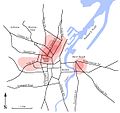
Main Catholic Districts, Belfast 1911.jpg 1,208 × 1,136; 73 KB
-
Map of punishment attacks in Belfast, 1998–2000.png 800 × 1,090; 910 KB
-
National Identity Belfast City Council 2011 Census.png 17,342 × 16,919; 7.43 MB
-
National Identity Belfast Metropolitan Area 2011 Census.png 16,565 × 16,917; 8.4 MB
-
Ordnance Survey One-Inch Sheet 6 Belfast, Published 1963.jpg 16,111 × 11,950; 20.07 MB
-
Population Density Belfast City Council 2011 Census.png 17,342 × 16,918; 7.35 MB
-
Population Density Belfast Metropolitan Area 2011 Census.png 16,510 × 16,861; 8.92 MB
-
Religion Belfast City Council 2011 Census.png 17,284 × 16,862; 8.52 MB
-
Religion Belfast City Council 2021 Census.png 3,507 × 2,480; 777 KB
-
Religion Belfast Metropolitan Area 2011 Census.png 16,566 × 16,917; 9.68 MB


