Category:Election maps of Belfast
Jump to navigation
Jump to search
Media in category "Election maps of Belfast"
The following 19 files are in this category, out of 19 total.
-
 Belfast Corporation Election 1914 (Ward Results).svg 610 × 424; 159 KB
-

-
 Belfast Corporation Election 1955 (Ward Results).svg 610 × 424; 313 KB
-

-
 2001 Belfast City Council Election Map.png 958 × 721; 71 KB
-
 Belfast City Council election, 2005 (Party with most votes by district).svg 5,033 × 4,840; 15 KB
-
 2005 Belfast City Council Election Map.png 958 × 721; 71 KB
-
 Belfast City Council election, 2011 (Party with most votes by district).svg 5,033 × 4,840; 15 KB
-
 2011 Belfast City Council Election Map.png 958 × 721; 72 KB
-

-

-

-
 2023 Belfast City Council Election Results.svg 5,000 × 3,278; 330 KB
-
 Belfast - 2014 v2.png 1,158 × 843; 173 KB
-
 Belfast - 2014.png 800 × 529; 101 KB
-
 Belfast 2011 election.svg 1,360 × 1,001; 246 KB
-
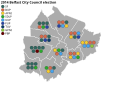 Map of 2014 Belfast City Council election.svg 1,902 × 1,388; 415 KB
-
 Map of 2019 Belfast City Council election.svg 1,902 × 1,388; 414 KB
-
 Map of the 2019 Belfast City Council election.svg 2,212 × 1,464; 414 KB
.svg)
.svg)
.svg)
.svg)

.svg)

.svg)

.svg)

.svg)


